2023/02/26 09:16:16
Cima Watles sulla neve
Author
Place
Italy - Trentino-Alto Adige/Südtirol, BZ
Km
12,46 km
Elapsed time
02:17:51
Vertical meters
+900 mt (1700 - 2569)
Route difficulty
Landscapes
Last update
2023/02/26 10:18:15
Comments
Description
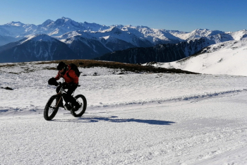
Beautiful all-snow route, rather short but not easy, with an incredible panorama to say the least!

Best done at least a week after the last snowfall so that the snow is hard enough.
Ideal in spring when the snow has turned. Beware of windy days because it pulls hard at the top, especially from the north. Ideal to do by e-fatbike, but also by e-bike plus, because at the top there are some very steep breaks, rideable at the limit with motor, pushable instead with regular bike.

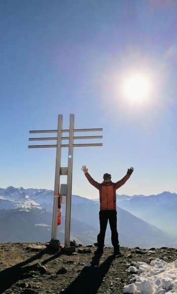
You go up first on the toboggan run, always well maintained, and then in the wilderness away from the lifts on cat-beaten track. At the top of Watleskopf, 2556 meters, fabulous 360-degree panorama of the Venosta and Swiss Alps.
Fantastic descent!

Local weather

°C

°C

°C

°C

°C

°C
Graph
Nearest Routes
77,02 km
Km
+3 100 mt
Vertical meters
Route difficulty
Landscapes
47,44 km
Km
+1 800 mt
Vertical meters
Route difficulty
Landscapes
2023/07/18
- Italy - Trentino-Alto Adige/Südtirol, BZ 48,77 km
Km
+1 461 mt
Vertical meters
Route difficulty
Landscapes
2023/02/26
- Italy - Trentino-Alto Adige/Südtirol, BZ 36,98 km
Km
+800 mt
Vertical meters
Route difficulty
Landscapes
31,43 km
Km
+1 420 mt
Vertical meters
Route difficulty
Landscapes
32,12 km
Km
+876 mt
Vertical meters
Route difficulty
Landscapes
2023/03/04
- Italy - Trentino-Alto Adige/Südtirol, BZ 85,06 km
Km
+2 720 mt
Vertical meters
Route difficulty
Landscapes
2023/07/03
- Italy - Trentino-Alto Adige/Südtirol, BZ 62,82 km
Km
+2 000 mt
Vertical meters
Route difficulty
Landscapes
26,70 km
Km
+600 mt
Vertical meters
Route difficulty
Landscapes
2024/02/02
- Italy - Trentino-Alto Adige/Südtirol, BZ 16,43 km
Km
+1 000 mt
Vertical meters
Route difficulty
Landscapes


 Italiano
 Deutsch