HOME RANKINGS CHALLENGES ROUTES NEAR ME PLANNING SEARCH LOGIN
Italy - Trentino-Alto Adige/Südtirol, BZ
2026/08/20 17:43:43

Giro dei Tre Confini versione gravel

97 Downloads
0
 
Share

Key Takeaways / Scheda Tecnica

Disciplina:
Mountain Bike (MTB)
Percorso:
Giro dei Tre Confini versione gravel
Località:
Italy - Trentino-Alto Adige/Südtirol, BZ
Distanza:
102,72 km
Dislivello Positivo:
+2 400 mt (Quota Min: 943m - Max: 2252m)
Difficoltà Tecnica:
2/5
Valutazione Panorami:
4/5
Formato Traccia:
GPX Download disponibile
Author
nonnocarb
(324)
Place
Italy - Trentino-Alto Adige/Südtirol, BZ
Km
102,72 km
Elapsed time
00:00:00
Vertical meters
+2 400 mt (943 - 2252)
Route difficulty
Landscapes
Last update
2026/08/20 17:51:46
Comments
3
Description

In all my years of mountain biking, I’ve done the Three Borders Loop in many different ways, but I’d never done it like this before—and it was truly wonderful! From Malles in the Upper Vinschgau Valley, you reach Lake Resia, then cross into Austria at Nauders.
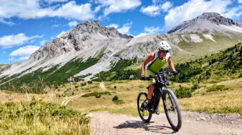
Foto itinerario MTB Giro dei Tre Confini versione gravel - Italy - Trentino-Alto Adige/Südtirol, BZ

From there, you take forest roads to reach the Inn Valley in Switzerland and follow the river all the way to Scuol.
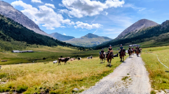
Foto itinerario MTB Giro dei Tre Confini versione gravel - Italy - Trentino-Alto Adige/Südtirol, BZ

A very long climb up the S-Charl Valley—endless but spectacular—to the Costainas Pass, followed by a final descent into the Val Monastero to return to Italy at Malles.
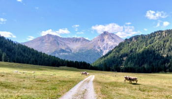
Foto itinerario MTB Giro dei Tre Confini versione gravel - Italy - Trentino-Alto Adige/Südtirol, BZ

A 103 km ride with 2,500+ meters of elevation gain, all on forest roads, bike paths, and non-technical trails; doable in either direction but I’d say it’s perfect when ridden counterclockwise. You can also do it on a #gravel bike
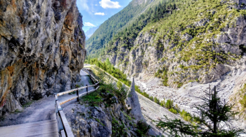
Foto itinerario MTB Giro dei Tre Confini versione gravel - Italy - Trentino-Alto Adige/Südtirol, BZ?


Download our free mobile app to send this route to your Garmin device or to navigate it on OSM maps. Android - iOS
Local weather
Tue 00:00
9 °C
Tue 12:00
11 °C
Wed 00:00
10 °C
Wed 12:00
12 °C
Thu 00:00
8 °C
Thu 12:00
9 °C
Fri 00:00
6 °C
Fri 12:00
7 °C
Sat 00:00
6 °C
Sat 12:00
9 °C

Graph

Nearest Routes

2025/11/10
- Italy - Trentino-Alto Adige/Südtirol, BZ
nonnocarb
(324)
85,80 km
Km
+2 800 mt
Vertical meters
Route difficulty
Landscapes
2023/07/18
- Italy - Trentino-Alto Adige/Südtirol, BZ
kcolrah
(5)
48,77 km
Km
+1 461 mt
Vertical meters
Route difficulty
Landscapes
2023/09/27
- Italy - Trentino-Alto Adige/Südtirol, BZ
77,02 km
Km
+3 100 mt
Vertical meters
Route difficulty
Landscapes
2023/03/06
- Italy - Trentino-Alto Adige/Südtirol, BZ
nonnocarb
(324)
47,44 km
Km
+1 800 mt
Vertical meters
Route difficulty
Landscapes
2026/08/27
- Italy - Trentino-Alto Adige/Südtirol, BZ
37,10 km
Km
+1 550 mt
Vertical meters
Route difficulty
Landscapes
2026/08/28
- Italy - Trentino-Alto Adige/Südtirol, BZ
20,14 km
Km
+1 072 mt
Vertical meters
Route difficulty
Landscapes
2023/03/04
- Italy - Trentino-Alto Adige/Südtirol, BZ
nonnocarb
(324)
85,06 km
Km
+2 720 mt
Vertical meters
Route difficulty
Landscapes
2023/02/26
- Italy - Trentino-Alto Adige/Südtirol, BZ
nonnocarb
(324)
12,46 km
Km
+900 mt
Vertical meters
Route difficulty
Landscapes
2023/02/26
- Italy - Trentino-Alto Adige/Südtirol, BZ
nonnocarb
(324)
36,98 km
Km
+800 mt
Vertical meters
Route difficulty
Landscapes
2023/03/06
- Italy - Trentino-Alto Adige/Südtirol, BZ
nonnocarb
(324)
31,43 km
Km
+1 420 mt
Vertical meters
Route difficulty
Landscapes

3 Comments
