Italiano
 Deutsch
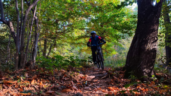
Bike Park Tajarè: sentiero dei castelli, percorso viola

SIMPLE AND TOURISTIC LEVEL, IT IS THE LOWEST ELEVATION AND FAMILY-FRIENDLY (BUT FAT-WHEELER-LOVING) TRAIL, WHICH CAN GIVE NICE VIEWS OF THE LOWER STURA VALLEY. THE SINGLETRACK, WHICH STARTS BEHIND THE WOODEN CABIN + GATE, IS HOWEVER NOT TO BE UNDERESTIMATED.
-Difficulty: easy climb (TC+), easy/medium descent (TC, MC sections), weak exposure (e1)
-Length: 12.7 km, elevation gain: 300 meters. Recommended time: year-round with no snow.
-Round route: Gaiola - Castelletto di Roccasparvera - Braida - Gaietto - Moiola- Stiera - Gaiola.
-Departure and arrival: Gaiola
DESCRIPTION
From the start (Via Gugliemo Marconi) take the provincial road towards Rittana. When you reach Castelletto, turn left towards Rittana/Paraloup always on asphalt. Just before Rittana (2.6 km) turn left onto a small wooden bridge and then onto a dirt road. At the end of the short descent (3.8 km) turn sharply right on flat path bordered by dry stone wall. Shortly after the chapel you need to take the descent on easy dirt road, then turn left arrived on asphalt. At the small square keep right and after about 50 meters of descent pay attention and deviate sharply to the right on asphalt climb (4.9 km). The road flattens out, becomes unpaved again and is to be followed to the left uphill. The beautiful view of Gaiola accompanies you and without any possibility of error you arrive at Braida.
From here (5.9 km) uphill on asphalt, after 2 sharp bends, at the wooden house, keep left on level ground and take the path downhill (lockable gate), the only technical section of the route. Once on asphalt, follow the provincial road to the right uphill, and at the second bend (7.1 km) left again on dirt road. This leads to Gaietto, squeeze between houses and after a descent take a new dirt road to the right (8.2 km). 250 meters then right on uphill path. You continue without possibility of error until the first houses of Moiola. From here you return to asphalt road to follow downhill without detour until the fountain with the Washing Machine Monument (9.6 km). Turn left onto a secondary asphalt road, keep to the bike path that crosses the state road, and begin the descent to the Stiera Rafting Center. Cross the small bridge at the end of the descent and continue straight on the last climb back to Gaiola. At the first intersection, at the first house, turn left and take Via Piave, crossing the SS21 (11.9 km). At the Piazzetta del Pelerin turn right downhill and continue straight ahead, until the finish.