Italiano
 Deutsch
Cima Tombea Panoramico

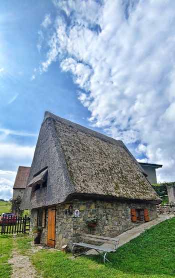
Today I am taking you on a tour of discovery of Mount Tombea, which, with Caplone and Tremalzo, represents one of the three highest peaks in the Alto Garda Bresciano Park and where there are military trenches and ambushes. We will also pass through the village of Cima Rest famous for its houses and barns characterized by their sloping thatched roofs.
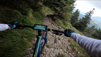
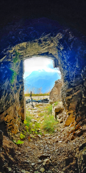
We leave the village Valvestino and climb on a paved road with little traffic to Armo. From here get ready to get out of reality: small descent and back uphill following the course of the Armarolo stream. A magnificent undergrowth will take us the locality Ponte Franato then continuing to Denai. You will already notice the first houses characteristic of the area with thatched roofs and you will be fascinated. Now we hold on because the climb becomes slightly more intense. We pass Pilaster on cemented roads, one last effort and then the road becomes pedalable and above all scenic dirt road again. We will pass under Dosso del Sellarollo, then Bocca di Cablone. From this point begin the trenches and military caves and a gentler traverse that will lead you, on a slight final descent, to Malga Tombea.
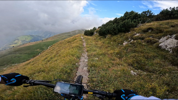
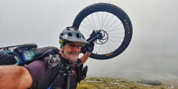
Here, if the day is nice and clear, I recommend climbing to the top of Mount Tombea (1,946 meters). Even with an E-Bike you can manage it by pushing it without any problems. From the top you will enjoy an immense 360-degree panorama. Well now the descent begins. Immediately interesting until Malga Tombea then a traverse in the meadows and finally here it is, the famous No. 267/B that will test you in the first part very technical and then become flowing and enjoyable in the second. We go up a few meters towards Malga Alvezza and reach Rest where you will find water and admire the famous Fienili di Cima Rest. From here we descend for a short stretch of asphalt to Bivio Camiòl: we return on mule track uphill for the last 150 meters of elevation gain to Sotto Strada di Camiòl. Final comfortable descent on gippabile that will bring you back to the starting point.
RECOMMENDED ROUTE FOR MOUNTAIN BIKE and/or E-BIKE ALL MOUNTAIN.
NB: At the time of entry this ride is all doable without any particular problems. We disclaim any responsibility for any inconvenience due to lack of maintenance of the trails or deterioration of the same due to external and/or natural agents and a wrong assessment of the tour.