Italiano
 Deutsch
Monte Stino 136 tornanti alternativo

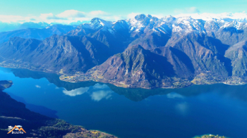
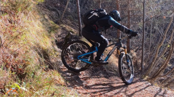
This great classic route on Lake Idro deviates from the orthodoxy in terms of the uphill section. It is my favorite route to Monte Stino, although I alternate it because it is the most tiring but also the most rewarding in terms of mountain biking, as it often leaves the asphalt in favor of dirt roads or trails and finally the grassy ridge (when not snow-covered) before the refuge, which already offers interesting views of Lake Idro.
The route starts from the large car park in Paröle, where a new kiosk is currently being built, and returns on asphalt to Vantone, where the dirt road begins (it was the old road to Capovalle) leading to the bridge on the SP 38. We follow the SP 38 before leaving it at a hairpin bend with a fountain on the left after 2.5 km. After a tough 1.5 km climb, we reach the junction with a votive shrine on the right. We return to the asphalt road and arrive at Capovalle. We cross the hamlet of Zumiè and, once past it, take the driveway to Monte Stino. We follow it for 2.2 km and, at a hairpin bend, leave it on the left to take a forest dirt road closed by a barrier, which is no impediment. Now we will not see the asphalt road again until we reach the car. We follow this track, which is a forest road but has fallen into disuse and has been reduced to a path for 1.2 km until it crosses the Alta via dei forti trail.
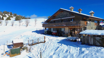
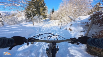
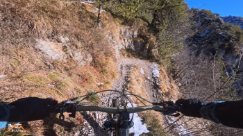
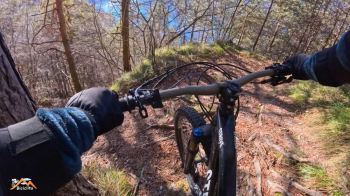
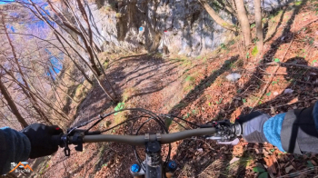
After 700 meters of this beautiful trail, which is difficult but always rideable, we arrive at a forest road. Keep to the left, follow it for 50 meters, then leave it on the left and climb a very short stretch to the grassy ridge, where we begin to admire views of Lake Idro. Soon we will be at the Monte Stino refuge. From here, a short stretch takes us to the top of the fortified point where the Italian flag proudly flies. Where the staircase to the panoramic viewpoint begins and ends, the formidable descent of 136 hairpin bends begins (I've never counted them, I'm too focused on the trail). Now we descend to the lake and forget about the track and the navigator, as it's impossible to go wrong.
The first section, a few meters, is impossible to ride, but even if it's never easy, it's doable, especially if you know how to do a nose press.
NB. The attached track is not the result of recording in the field, as I don't take my Garmin with me on local rides (this time I should have), but I created it in BaseCamp with the utmost fidelity to the actual route.