Italiano
 Deutsch
Val di Vesta area wilderness

A basic premise. We will be traversing an area of maximum environmental protection, theVesta Valley wilderness area, where nature takes its course, so trees on the ground are left wherever they fall, signage at some point if it doesn't disappear is decidedly less than what would be needed, the trail from the Vesta di Mezzo hut fades away for a long stretch and you are navigating by sensation/experience. If you're looking for a sensational descent, free of breaks and climbs to do some fun skidding, this is not the ride!
We start at San Rocco Pass in Capovalle (parking for 3-4 cars). Keeping to the left we take the forest road that with 5 km and 400 meters of elevation gain leads us to the Del Loss barn. We turn sharply to the right towards Monte Carzen. In front of a nice yellow cottage instead of continuing uphill through the meadow we take a left on a nice flat path to Vesta Pass. From the center of the pass we ascend Mt. Vesta (or Dosso del Cucchetto) devoid of signposts and trail but on the ground a few tracks are encountered in the steep meadow to the summit that will force us to a short but intense stretch with the bike on our backs.
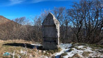
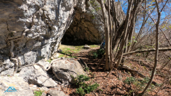
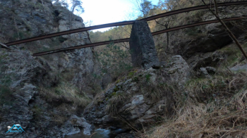
From Mt. Vesta (beautiful cippus of the old Austro-Hungarian border) we descend on the grassy shoulder with no trail to the very well maintained old Regia Guardia di Finanza customs house and proceed on obvious well-marked trail to Corna Rossa, a vantage point below Mt. Pallotto and Mt. Pallotto in the heart of the Val di Vesta Wilderness Area. Now we descend, take an obvious trail (not the one shown on the map, which is not there) and after 200 meters or so in the meadow we abandon it for a completely pathless descent that will allow us to merge into what remains of a forest trail to Malga Vesta di Mezzo.
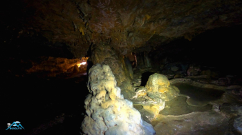
Here the trail I remembered I can't find or is no longer there so down through the woods until I intercept another trail that descends in the direction of Cuel Sant, our next destination. As I enter the alternate trail (I modified my track to that effect) things change and the trail remains not always clean but always well evident. At an altitude of 750 meters I intercept the detour to Cuel Sant, the main and spectacular ravine in the area, which I reach in less than 10 minutes. The beam of my flashlight illuminates and colors it, beautiful, somewhat low to the point that certain areas I reach only by crawling.
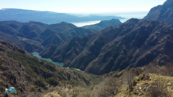
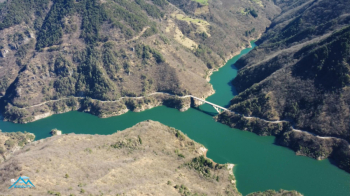
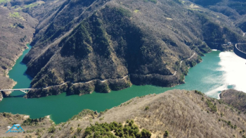
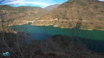
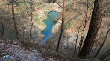
Having escaped the curse that hangs over that place I continue the fun descent to Lake Valvestino and in an undulating pattern we will always skirt the lake with glimpses of the breathtaking fjords as far as the village of Molino di Bollone, then back up to Capovalle to the car. Sensational trip but strictly for fans of the "if I get lost I won't get mad" genre with good orientation aptitude and wild situations as per the premise.