Italiano
 Deutsch
Cingla
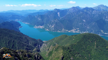
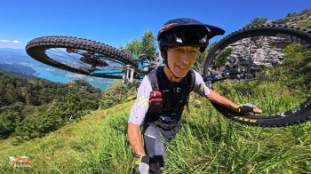
This daring mountain biking trip starts at the parking lot by the kiosk in Paröle on Lake Idro. Cingla is not an easy mountain to climb by bike, and you’ll have to carry your bike both uphill and downhill to reach the summit. It makes sense to leave your bike on the broom-covered meadow at 1,480 meters before the trail begins to descend—as it will do several times before reaching the summit— Up to that point, the section where you have to carry your bike is manageable, and the descent is wild and a lot of fun; beyond that, it becomes tiring and complicated.
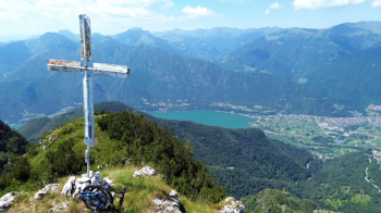
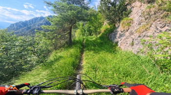
Return to the road toward Idro and take the old road—now partly a trail—toward Capovalle. Pass through the village and head back up the road toward Mount Stino. At an elevation of 1,220, you leave the paved road and, keeping to the left, continue toward Bocca Cocca. Head toward Bocca di Valle, and after 400 meters, take the trail on the left that climbs; from here on, you’ll just have to push and carry your bike. Continue along that trail until it joins the path ascending from the lake via Calva; follow it briefly upward through a steep meadow of broom, and in the beech forest above the meadow, the trail begins to descend. It makes sense to leave your bike here; theoretically, there are only 200 meters of elevation gain left to the summit, but there are three dips where you lose 150 meters, and the route becomes much more challenging due to its steepness and the dense vegetation. I highly recommend visiting the summit on foot.
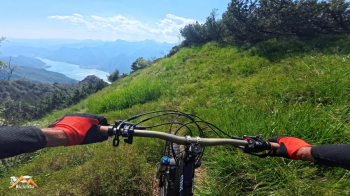
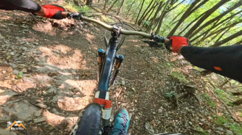
On the way back, you’ll ride down the steep but manageable broom-covered meadow with a wonderful view of the lake; then, keeping to the left, you’ll enjoy a fun descent down the Valvestino slope until you reach the Lanzichenecchi trail, which you’ll follow all the way to Calva—it’s a blast. And it doesn’t end there—now you descend the incredibly fun and popular Calva trail to the lakeshore in the village of Vesta, and from there it’s a short ride back to the car.
This is a relatively easy and very fun ride up to the broom meadow, but it becomes very, very difficult and strenuous if you want to reach the summit with your bike in tow.