
 Italiano
 Deutsch
Guglie Bianche del Lebendum 2940 xxl
The traverse in Val Formazza from ref. Somma to ref. Margaroli via the White Spires of Lebendum has only recently been marked with stone cairns and white/red bolts and included in the trail cadastre. Previously the preserve of only a few enterprising hikers with knowledge of the area, it is now mostly frequented by a/r from ref. Somma to the White Spires.
Doing the full traverse means doing a loop that also includes the Nefelgiu Pass and is almost always done in two days with an overnight stay in one of the refuges. You cross one of the wildest and most remote corners of Formazza.
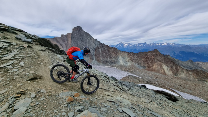
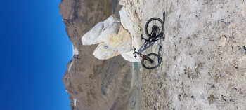
Endless scree, fine scree in contrasting colors, glaciers, emerald lakes and the White Spires. Panorama madness unbelievable. The downside is that it is downright hostile to two wheels. Few sections timidly rideable with technique, the rest portage to climb, descend and traverse in a high mountain environment with trail not always obvious.
Obviously all this could not be enough so I wanted to create a wide loop that fully acquaints the beautiful Formazza. Start from Valdo with parking in front of the soccer field.
Water points up to Riale reached on bitumen. Sterro going up to Bettelmatt plain and then shoulder to Gries pass. Pushes and pedaled sections towards Chamois Peak where at the col we take the descent to ref. Busto. Attention short deportages with chains.
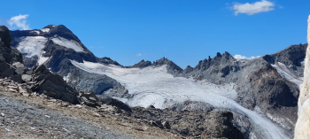
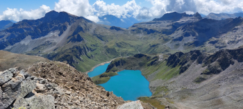
Crossed the Piana dei Camosci we shoulder in the direction of the Sidel glacier ( now almost nonexistent). We move left (orographic right) and on scree we reach ref. 3A. We descend easy with great fun first to ref. Claudio&Bruno then to the Sabbioni dam and again up with easy push to ref. Somma. Some pedaling on exposed trail (caution) and then pushing until we reach the headland overlooking Lake Gemelli di Ban.
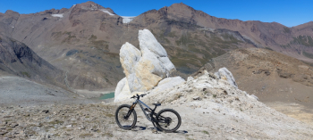
Descent to the body of water on totally cyclable stones to then begin the cinema already written about. From the White Spires to the Vannino Pass long traverse on very large jugs, tiring and not always obvious.
From the pass the first part of the descent is promising if you have technique but then becomes untameable and endless. Reaching Lake Sruer you pedal and then descend again and again with good difficulty to ref. Margaroli. From here if you are still in one piece you descend easy and fast with dirt to the car.
In conclusion ROUTE formidable hard and difficult by stratospheric views but for the exclusive use of fans of the genre (but really a lot) with top form and accustomed to high mountain environment and navigate on sight on difficult terrain. Final note: done the other way around I assess there are more cyclable downhill sections provided there are endless portages.
 The trav


