
 Italiano
 Deutsch
Trittico alpino: Gottardo, Furka, Novena

The triptych of Swiss passes between north and south of the watershed-St. Gotthard, Furka and Nufenen-to be done by road bike.
You start in Airolo, parking for free at the Pesciüm cable car, and climb up to the Gotthard on the famous Tremola road, typical with its porphyry sections and beautiful hairpin bends to admire from above. When we get to the pass, we go all the way down to Andermatt on the cantonal road, which, if there is a traffic jam on the highway, is very busy because people try to decrease their waiting time by passing at high altitude.
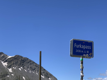
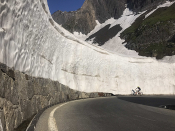
From Andermatt we continue to the Furka on a short flat section before tackling the second pass of the day. The problem with the Furka is that you can see the pass in the last very long section, and it seems like you never get there. From the pass downhill at breakneck speed, very long, to Valais. We also pass through the now closed Belvedere Hotel, from which we could see a glacier that has now receded.
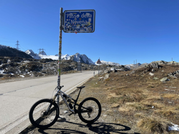
Arriving at the bottom of the valley comes the last feat of the day, and that is the hard (very hard after the miles and meters you will have in your legs) Nufenen Pass. I recommend a stop at the Ulrichen supermarket to refresh yourself. Again, the problem here is the final part: a wall of hairpin bends looking down on you, and you counting the meters of elevation gain missing to get to the highest pass pass pass pass passable by car in Switzerland.
When you reach the top, enjoy the view of all the Alps and dive into a descent where you'll hit 90 km/h if you don't have a south wind holding you back. 20+ km of enjoyment that will take you back to Airolo.
You can see the descent from the Nufenen Pass here:


