Italiano
 Deutsch
Dalla Val Bedretto alla Val Formazza e ritorno

One of the most beautiful routes in the Central Alps. You can start either from Ossasco (Switzerland) or from Riale (Italy).
Start from Ossasco, in Val Bedretto, and follow the Passo della Novena road up to the pass. The climb is long and entirely on paved road, but it’s one of the great climbs in the Alps, so you’ll feel a sense of accomplishment once you reach the top, where there’s a bar to grab a bite to eat if you’d like.
Descend toward the Valais region, and at the second hairpin turn, leave the pass road to head toward Lake Gries.
You’ll see that the road is officially closed due to rockfalls, but everyone still goes through. EDIT: In August 2023, they installed a gate to prevent passage:
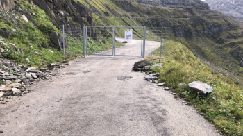
Do not pass through in case of rain or bad weather; there is a risk of a landslide. Pedal quickly and exit the danger zone as soon as possible.
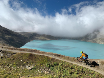
This brings you to the wind-swept ridges overlooking the beautiful Lake Gries. From here, a magnificent trail descends toward the lake and then runs along its shore, taking you to the border with Italy, where the long descent into Val Formazza begins.
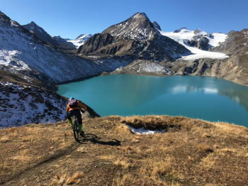
This descent was improved a few years ago, but its difficulty varies depending on water erosion.
You’ll descend to the Bättelmatt plain and Lake Morasco. The trail in this section is technical but a lot of fun.
We then arrive in Riale, where I strongly recommend stopping for lunch or at least grabbing a bite to eat, because now we’ll be climbing back up toward Passo San Giacomo, passing by Lake Toggia.
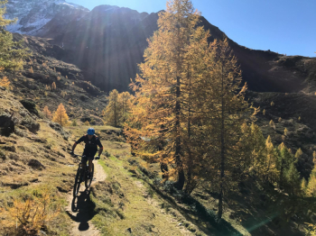
From Passo San Giacomo, we take the trail—recently widened for mountain bikes—and stay high above the Val Bedretto. We don’t descend to Acqua, where the official route would take us (an easy descent, if you want to avoid the technical sections that follow my route instead), but we continue to stay high up.
Once past Alpe Cristallina, the trail becomes a series of ups and downs with technical sections; the first part of the descent toward Ossasco is also technical, and we reach Ossasco via a trail through the woods.