
 Italiano
 Deutsch
Saflischpass

The Saflischpass round trip is beautiful, but it lacked a complete round trip without transportation(here the round trip with train return). This alternative adds some elevation gain and a few miles but on moderate inclines and traffic-free roads. The start is from the free parking lot of the gondola to Rosswald, so you finish after the single track.
The first part is downhill first on small roads then on very fun single track until you reach the Rhone valley, follow the bike path for 2 km and turn onto paved road. A flat single track leads to connect to other road at first paved then becomes dirt road leading to cross the Binna River on nice bridge (beautiful clear water gorges).
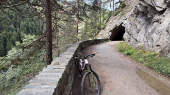
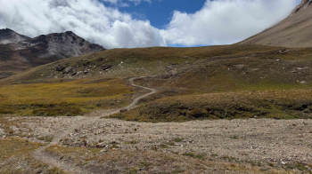
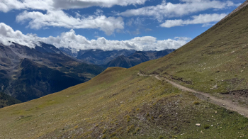
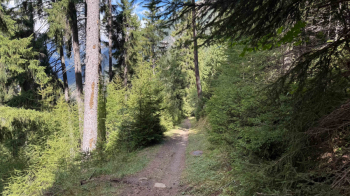
The trail is wide, nice and pulled to a shine. It climbs with a few somewhat hard switchbacks until it connects to the classic loop, avoids the tunnel by following the old road (now pedestrian and bicycle only), and does all the gorges until you reach the pond. From here on dirt roads with good gradients (only one section is steeper but still well pedalable) you follow uphill until you take the trail to the pass.
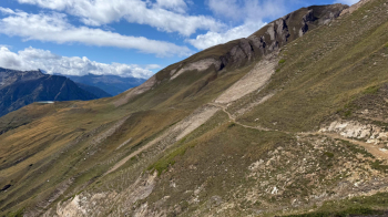
First short push piece and then on trail recently arranged for bikes, beautiful (last meters steep but rideable by those in good shape).
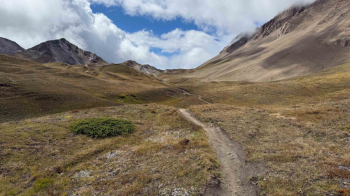
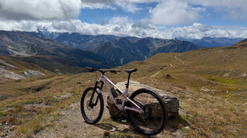
Panoramic break at the pass and from there the very long descent, very fast and beautiful, not trivial because of the speed (S2).
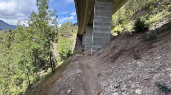
At Staffel it is better to follow our track via the road because the trail is forbidden to bicycles. From Rosswald follow trail 36, fast, a little bumpy with nice, not difficult switchbacks (S2), passing under the Simplon road.
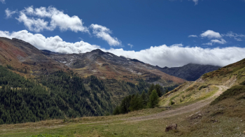
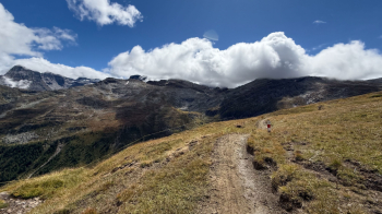
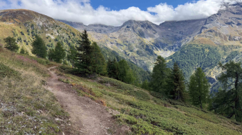
A note on the views. They range from low-altitude landscapes with "Swiss-style" meadows to the remarkable and wild Binna Gorge, but the higher you climb the wider the view widens to high mountain pastures. At the pass then the gaze sweeps over the entire lower and middle Valais.


