HOME RANKINGS CHALLENGES ROUTES NEAR ME PLANNING SEARCH LOGIN
Italy - Piemonte, TO
2026/06/20 19:13:35

Cima Bossola - Valchiusella

0 Downloads
0
 
Share

Key Takeaways / Scheda Tecnica

Disciplina:
Mountain Bike (MTB)
Percorso:
Cima Bossola - Valchiusella
Località:
Italy - Piemonte, TO
Distanza:
7,36 km
Dislivello Positivo:
+500 mt (Quota Min: 963m - Max: 1404m)
Difficoltà Tecnica:
1/5
Valutazione Panorami:
3/5
Formato Traccia:
GPX Download disponibile
Author
gmzolenart
(137)
Place
Italy - Piemonte, TO
Km
7,36 km
Elapsed time
01:58:00
Vertical meters
+500 mt (963 - 1404)
Route difficulty
Landscapes
Last update
2026/06/20 21:33:15
Comments
0
Description

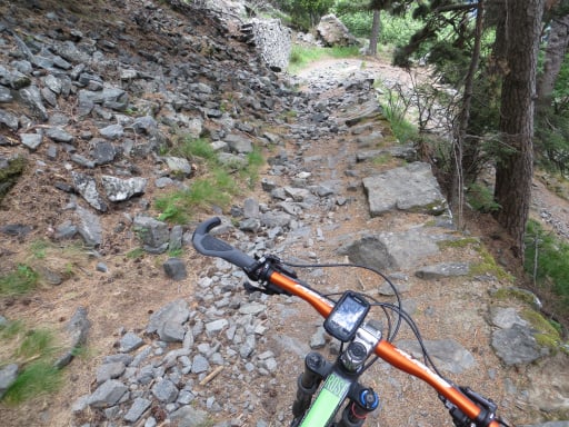
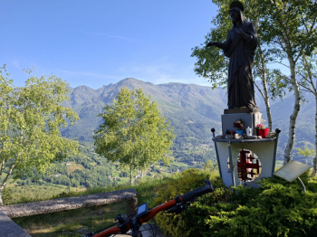
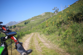
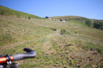
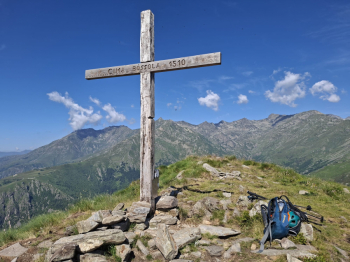
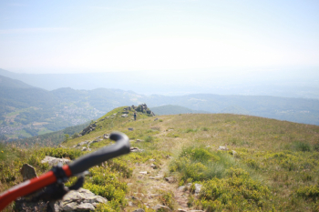
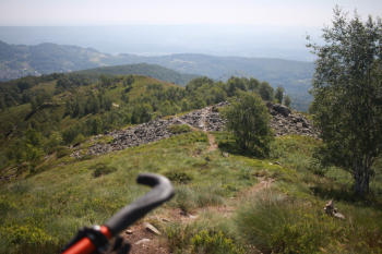
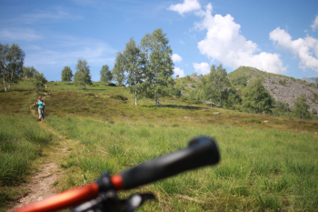
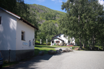
From Ivrea, take the Valchiusella provincial road toward Vistrorio, then Rueglio, Trausella, and Inverso, and then climb to the parking lot of the Cima Bossola hiking shelter (closed on weekdays). On a mountain bike, continue along the dirt road for one kilometer, then turn right and begin the climb through lush vegetation of birch and broadleaf trees that provide relief from the heat. You’ll soon reach Madonna Nostra Signora di Palestina, which offers a beautiful view of Traversella. Continue out of the woods and, after a long traverse, you’ll reach Case Bossola. Here the climb begins; avoid turning right toward the privately owned houses and instead continue on the rocky trail to Colletto di Bossola. From here, the final rideable stretch leads to the summit. The descent, on the other hand, follows the hiking trail along the ridge, which alternates between flowing sections and more technical sections, ranging from BC to OC. A short but varied route—best avoided on hot days.

Dirt road ascent through the woods
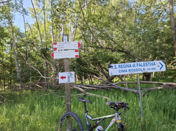
Foto itinerario MTB Cima Bossola - Valchiusella - Italy - Piemonte, TO

Our Lady of Palestine

Foto itinerario MTB Cima Bossola - Valchiusella - Italy - Piemonte, TO

Traverse and view of Cima Bossola

Foto itinerario MTB Cima Bossola - Valchiusella - Italy - Piemonte, TO

Ascent

Foto itinerario MTB Cima Bossola - Valchiusella - Italy - Piemonte, TO


Foto itinerario MTB Cima Bossola - Valchiusella - Italy - Piemonte, TO

First section of the descent

Foto itinerario MTB Cima Bossola - Valchiusella - Italy - Piemonte, TO


Foto itinerario MTB Cima Bossola - Valchiusella - Italy - Piemonte, TO

Very smooth section

Foto itinerario MTB Cima Bossola - Valchiusella - Italy - Piemonte, TO

Cima Bossola Hiking Shelter

Foto itinerario MTB Cima Bossola - Valchiusella - Italy - Piemonte, TO

Download our free mobile app to send this route to your Garmin device or to navigate it on OSM maps. Android - iOS
Local weather
Mon 00:00
10 °C
Mon 12:00
11 °C
Tue 00:00
10 °C
Tue 12:00
9 °C
Wed 00:00
10 °C
Wed 12:00
12 °C
Thu 00:00
7 °C
Thu 12:00
12 °C
Fri 00:00
8 °C
Fri 12:00
8 °C

Graph

Nearest Routes

30,47 km
Km
+1 080 mt
Vertical meters
Route difficulty
Landscapes
2022/09/22
- Italy - Piemonte, TO
gmzolenart
(137)
23,00 km
Km
+900 mt
Vertical meters
Route difficulty
Landscapes
2026/07/01
- Italy - Piemonte, TO
gmzolenart
(137)
11,55 km
Km
+630 mt
Vertical meters
Route difficulty
Landscapes
2026/09/06
- Italy - Piemonte, TO
gmzolenart
(137)
10,97 km
Km
+500 mt
Vertical meters
Route difficulty
Landscapes
2022/08/22
- Italy - Valle d'Aosta, AO
nonnocarb
(324)
24,52 km
Km
+466 mt
Vertical meters
Route difficulty
Landscapes
2026/09/13
- Italy - Piemonte, TO
gmzolenart
(137)
20,94 km
Km
+850 mt
Vertical meters
Route difficulty
Landscapes
2022/09/18
- Italy - Valle d'Aosta, AO
gmzolenart
(137)
18,95 km
Km
+1 050 mt
Vertical meters
Route difficulty
Landscapes
2022/11/18
- Italy - Piemonte, TO
gmzolenart
(137)
21,96 km
Km
+735 mt
Vertical meters
Route difficulty
Landscapes
2022/11/20
- Italy - Piemonte, TO
gmzolenart
(137)
29,49 km
Km
+1 172 mt
Vertical meters
Route difficulty
Landscapes
21,49 km
Km
+921 mt
Vertical meters
Route difficulty
Landscapes

0 Comments