Italiano
 Deutsch
Cuorgnè - Alpe Monsuffietto and Pacarina - counterclockwise

Counterclockwise turn west, then south, finally east on the Orco Valley ridge and into the Gallenca Valley.
Start from the square in Cuorgnè and follow the old road of Alpette, then follow the sign on the left towards the hamlet of Ronchi, on the road we meet a small church dedicated to San Bernardo.
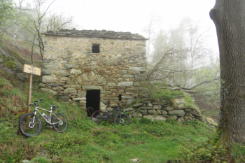
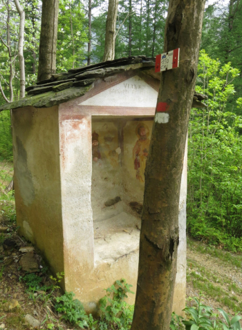
In the hamlet of Ronchi, after about 3.8 km from the start, the asphalt road ends and a wide dirt road begins on the right; the sign indicates trail 406 - 1.30 Monsuffietto. You enter a dense vegetation mostly of oaks in which tabernacles and remains of stone peasant houses appear every now and then, for example in Turale. At the few forks you keep to the right three times, last fork to the left for Alpe Monsuffietto.
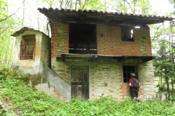
Alpe Monsuffietto at an elevation of 1150 m is a balcony over the Valle dell' Orco, Quinzeina and S. Elisabetta with the only water source on the trail at which to refresh before a steep uphill section; the trail becomes BC for a few hundred meters to a fork near a cistern. We veer left on an uneasy path through a forest of local turkey oaks and, on a slight descent, arrive at Alpe Pacarina with some ruined houses.
The descent (trail 416 - mtb 3) along a wide dirt road leads us to Sombeila, hamlet of Canischio; after a short stretch on asphalt, on the left we take another stretch of the Gallo trail in the hamlets of Ricauda and Camerlo, near Cuorgnè. The last stretch is carried out on an asphalt road.
Mid-mountain trail, good for all seasons, beware of wet sections.
Map No. 4 Sacred Valley Frassinetto - Belmonte - Alice Superiore, MU Editions.