
 Italiano
 Deutsch
2022/11/20 18:50:36
Cuorgnè - Cima Mares e discesa da Rocche San Martino
Author

Place
Italy - Piemonte, TO
Km
29,49 km
Elapsed time
04:37:23
Vertical meters
+1 172 mt (402 - 1547)
Route difficulty
Landscapes
Last update
2023/01/20 17:48:49
Comments
Hotels
Description
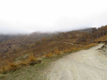
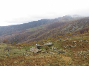
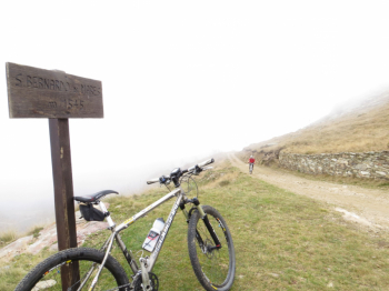
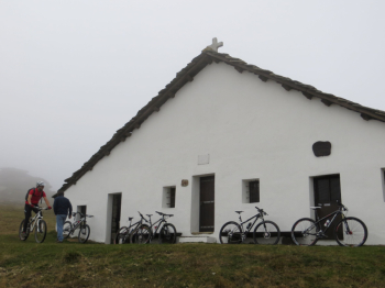
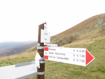
Start from Courgnè on asphalt, following the Sentiero del Gallo, a charming balcony path that is almost completely cyclable. Reaching Canischio, pass the Madonna della Neve Sanctuary 877 m and continue on the road, almost immediately dirt, that steeply leads to San Bernardo di Mares 1554 m. A trail climbs steeply in a northeast direction and leads to the summit of Cima Mares 1654 m.
There are several descent variants, Balmassa, Pian Pessa and then our own, trialistic to Rocche San Martino and then grassy sections, single trail and dirt track to Sombeila. From here asphalt to Cuorgnè.
Local weather
Wed 00:00

24 °C
Wed 12:00

28 °C
Thu 00:00
19 °C
Thu 12:00

27 °C
Fri 00:00

24 °C
Fri 12:00

28 °C
Graph
Nearest Routes
2022/11/17
- Italy - Piemonte, TO 21,49 km
Km
+921 mt
Vertical meters
Route difficulty
Landscapes
21,96 km
Km
+735 mt
Vertical meters
Route difficulty
Landscapes
23,00 km
Km
+900 mt
Vertical meters
Route difficulty
Landscapes
20,30 km
Km
+1 200 mt
Vertical meters
Route difficulty
Landscapes
19,00 km
Km
+980 mt
Vertical meters
Route difficulty
Landscapes
14,22 km
Km
+871 mt
Vertical meters
Route difficulty
Landscapes
11,55 km
Km
+630 mt
Vertical meters
Route difficulty
Landscapes
7,36 km
Km
+500 mt
Vertical meters
Route difficulty
Landscapes
14,82 km
Km
+618 mt
Vertical meters
Route difficulty
Landscapes
2022/08/06
- Italy - Valle d'Aosta, AO 29,26 km
Km
+1 467 mt
Vertical meters
Route difficulty
Landscapes