Italiano
 Deutsch
Monti Pracaban e Pavaglione (GE)

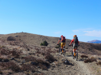
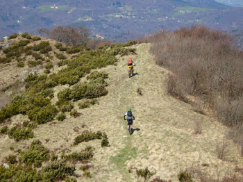
This hike begins in the village of Rossiglione (GE) in the Ligurian Apennines, where we park the car in a free parking lot along the stream. The route starts with a gently sloping stretch on a paved road, followed by some very challenging climbs with a few sections requiring a push on the dirt road. We reach the ridge separating the provinces of Genoa and Alessandria, heading toward the summit of Monte Pracaban at 946 meters. A very brief 5-minute stop at the summit, then we begin the descent on an open, scenic trail.
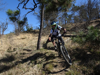
Returning into the woods, we lose elevation on the Barbanera and Revenge trails; the first is very flowy, while the second is steeper and features some technical sections. These trails were very enjoyable when ridden on April 4, 2026, and were found to be in perfect condition. Revenge ends in a small residential area where you must moderate your speed to avoid accidents with maneuvering cars and residents (there are signs on the trail).
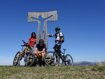
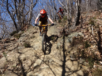
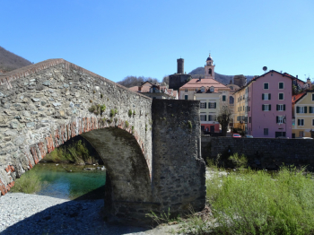
We now head to Campo Ligure, one of Italy’s most beautiful villages, where we can admire the hexagonal-based castle, the medieval bridge, and the colorful houses overlooking the stream. We turn onto an uphill road, pass a short flight of stairs after going under the highway, and gain elevation via a wide loop on asphalt without encountering a soul. The final few meters before reaching the summit of Monte Pavaglione at 890 meters are on a trail. From the cross, the "Il Poggio" trail begins—a trail that has it all: rough sections, flow sections, jumps, panoramic views, and at the end, a steep rock garden. The trail ends beneath the highway where rain has caused damage, and you must walk down until you cross a small stream. Once you’ve climbed back up to the other side, be careful not to end up on private property. We return to the car after a well-deserved stop at the ice cream shop located near the bridge over the stream.
The downhill trails were the subject of two Special Stages in the 4Enduro race held in May 2024 and are still maintained by ASD VAL STURA HIKE & BIKE, to whom we extend our thanks.
For any further information, please refer to the photo report.