Italiano
 Deutsch
Monte Reixa e Dazio trail

This route features long stretches where you’ll have to push or carry your bike, as well as a very technical descent that requires the right mindset and a good pair of shoes in one of the most beautiful spots in Beigua Park. As with all MTB excursions, it’s essential that the weather is good!
The start is at the convenient free Rodocanachi parking lot near the Arenzano train station, where you must be careful not to "stretch" the peacocks roaming freely among the cars. You pass through the station’s underpass and, once outside, climb a short, narrow staircase. We pass in front of the Shrine of the Infant Jesus of Prague and are ready to begin the ride. We head uphill along the “Sentiero degli Inglesi” (English Trail), which is in perfect condition; here, you must watch out for cyclists coming down, as the trail is two-way.
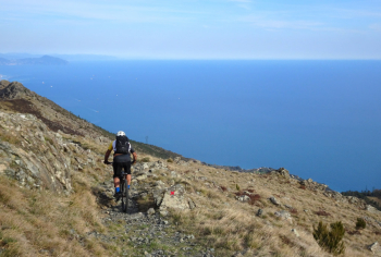
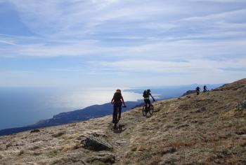
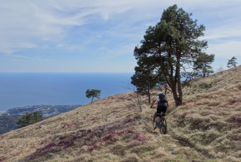
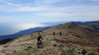
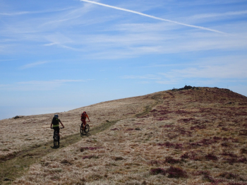
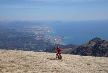
We arrive at Passo Gua, where a scenic dirt road takes us—with some tough but always rideable sections—to Passo della Gava at 752 meters. Now, carrying our bikes or pushing them, we take the path slightly to the right, which, via a wide detour, leads us to intersect the Alta Via coming from Passo del Faiallo. On this scenic stretch, long sections of pushing or carrying the bike alternate with rideable traverses offering sea views. Once we reach the Alta Via, we get back in the saddle and, after several ups and downs, reach the summit of Monte Reixa with a spectacular view of the coast and Genoa.
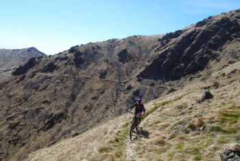
Continuing on, we arrive at the Argentea refuge, a popular destination for many hikers (please be careful). From the refuge, a beautiful traverse begins, featuring several shelters in case of sudden bad weather and various water sources, leading us to Ca’ della Gava. A short climb to Passo della Gava and the final 100 meters of elevation gain—pushing or carrying the bike—to reach Passo Tardie. Descend on a rocky, exposed trail (caution!) to Ca' del Dazio, where, turning slightly right, the descent of the same name begins, marked with a red A. The trail is not easy—very technical with rocks everywhere—until a stretch through a pine forest where you can catch your breath. After the section in the pine forest, turning left, the trail becomes even more difficult (impossible for us to ride).
After a short stretch partially blocked by brambles, we reach the highway overpass and finally the cars, passing through the park.
Before embarking on this excursion, please consider the following:
- 450 meters of elevation gain where you’ll have to push or carry your bike—not heavy but long stretches
- the high difficulty of the second part of the Dazio Trail.
- However, this excursion—despite being just a stone’s throw from the sea—offers glimpses of the real mountains!
For more information and photos, please refer to the photo report.