
 Italiano
 Deutsch
Monte Reixa e Tardie

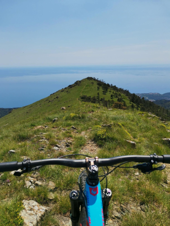
Mount Riexa is a small, hyper-panoramic peak of the Beigua group that can't be missed in the mountain biker's arsenal who loves natural and pissed off trails! The descent is one of the longest, most scenic and technical in the area!
Here I describe the most classic and fast ascent from Passo del Faiallo that although on asphalt is very beautiful, but it is also possible to get there in a more direct way without asphalt from Passo della Gava (40 min. bike x red) or by traversing from Prariondo. Departure terminus of bus No. 1 in Voltri, we go up the so called Cannellona road that in no time takes us to an environment totally out of traffic and in open countryside despite being a few km from the city! With steady ascent we arrive to intercept the road that from the Turchino Pass goes up to the Faiallo Pass, here we can follow the asphalt road in its entirety, or in the first section we can take a dirt road on the north side that rejoins after forte Geremia.
In an almost alpine environment we arrive at Faiallo from which we take the path that we manage to pedal for a few hundred meters, then we leave out the flat path to the Gava and climb to the right pushing or with bike on the shoulder for 10 min. to reach the flat summit with a few pedal strokes.
From the summit we retrace our steps briefly (straight waterfront from the summit part path x red that descends to the direct to the Gava with very pissed path but sometimes hidden by tall grass) we instead go to intercept the traverse that descends to the Gava with very nice path, always clean but still very challenging on fixed rock that requires determination, good arms and strong tires!
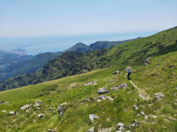
Arrived at the Gava nice whipped we go up verse the Tardie, the main path is rocky and forces you to push for a stretch, but if you are lucky to find it clean on the left there is a parallel variant more cyclable that passes on the grass and that allows you to pedal almost entirely. At the Tardie pass I recommend making a detour to the summit on the right (10 min).
Back at the pass we descend following the red x, here the path is wide but always quite technical on both fixed and movable rock, attention only to a somewhat exposed bottleneck where you must not fall, then we pass by the Ex Casa del Dazio from which on the right starts the path to Arenzano, we continue keeping left always on the red x.
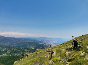
Here the trail is always beautiful, never trivial, narrow but often cleared by local bikers, always on fixed rock and all to be ridden with determination, in some sections there are small variations to avoid the more rocky and hollowed out sections until you get to a junction with a wider trail. Here we could descend to Crevari with easy paths but we try to finish in beauty and so keeping to the right we descend until we reach a crossroads where we follow a dirt road on the right for a short stretch, then at a hairpin bend we continue to the right until the entrance of the Sugarsu trail
Now the last and exciting trail awaits us, very different from the previous ones all to be driven always with care, in the woods with a more earthy bottom but always narrow and with slopes that are sometimes challenging and that wakes us up on the asphalt near a highway viaduct. All that remains is to descend on the Aurelia and return to Voltri


