Italiano
 Deutsch
Arenzano e il Dazio Trail
There are many variations running the trails above Arenzano; we chose to do it this way.
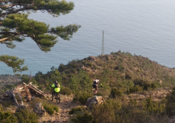
We start from a convenient parking lot along the Aurelia placed just after the Punta Nave tunnel. We pedal in the direction of Voltri where we begin to climb passing under the beautiful highway viaducts. Fortunately, we soon pass them and find ourselves on a secondary road with little traffic. The Canellona road, as they call it, will lead us with some initial effort and a few kilometers to the Valico di Favin where turning left we follow the Alta Via dirt road that passes near Forte Geremia. In a short time we are still on the asphalt road that we follow for about 5km in the direction of Passo del Faiallo, a route cheered by the lunar panorama of Monte Giallo and Bric del Dente.
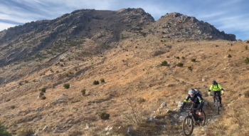
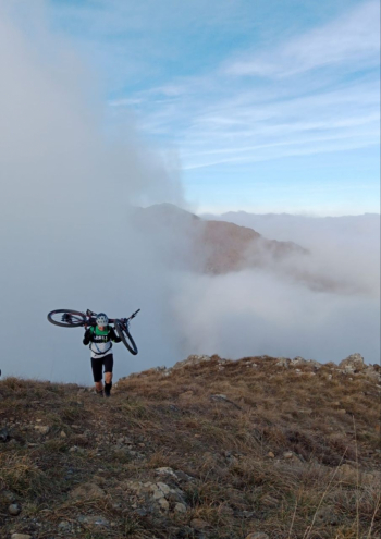
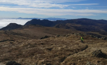
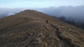
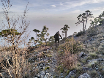
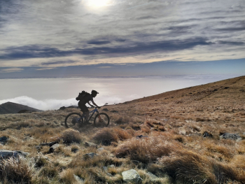
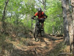
Cerusa Pass, 2 more hairpin bends and we arrive at Faiallo after a good 20km of climbing. Short coffee stop at the bar of La Nuvola Sul Mare Restaurant. Shamelessly ignoring the manager's cycling advice, we head to the summit of Monte Reixa for the ill-advised Alta Via per Cresta; but why ill-advised? Beautiful route partly cyclable in a stratospheric environment! We ride all the way along the summit ridge passing by Monte Reixa and Rocca Vaccaria in the direction of Rifugio Argentea, how wonderful! We do not reach the hut but at Crocetta Pass we turn left where on a labile grassy track we reach a narrow and panoramic as well as technical trail that connects us to V Bianca. Still with a good technical level we reach the Gava Pass. Now a couple of pedaled hairpin bends and soon after bike on our shoulders and we climb to Monte Tardie di Ponente with some fatigue. Fatigue rewarded by the superb view from the summit. Protectors and down on a beautiful trail all in the saddle that leads us to Tardie Pass where once again we admire the remarkable view. Now we're dancing. We are on the trail called Ex Casa del Dazio or A Rossa. Classic Ligurian trail "smooth and fun" cit. Trail with a remarkable mix of rock views and technicality. Best done after enjoying a tasty focaccia obviously Ligurian. The trail ends at Bicocca and shortly between steps and lanes we are on the sea to enjoy a well-deserved beer. A few kilometers on the Aurelia and we are at our cars.