Italiano
 Deutsch
Città Morta, Val di Castel, Bocchetta di Strino
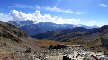
Great tour purely cyclo-mountaineering, relatively short but challenging, very little pedaling uphill. Very nice trails, enjoyable descent, long final traverse very pleasant, all on the pedals. Wild alpine environment, very open, first-rate, enchanting Strino lakes. Splendid views of Cevedale, Sull'Adamello and Presanella. Remarkable remains of the First World War. If you wish, a half-hour walk from Bocchetta di Strino will take you to the summit of Redival, 2973 meters (1°; F+).
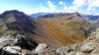
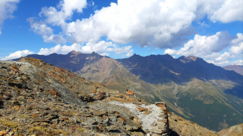
We start from the charming old hospice of S. Bartolomeo, 1960 meters, just above the Tonale Pass. We climb pedaling to the nearby Albiolo reservoir, keeping it on our left we climb first to the right and then straight up on trail, pedaling until just before a junction at 2160 meters. We turn right, pushing and carrying the bike (we pedal only a very short distance) to reach the shoulder, at meters 2570, below the Tonale Orientale peak (reachable in 20 minutes only on foot) and overlooking the characteristic Città Morta. After admiring the northern slopes of Presanella we begin the first beautiful descent with a visit to the ruins of the old Austrian military village.
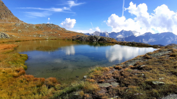
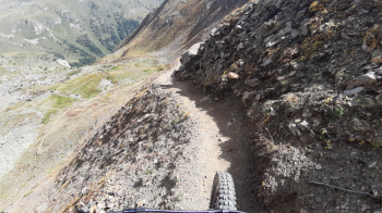
Leaving the village we pay attention to the fork, where we turn left, marker 161, towards Val di Castel, Bocchetta di Strino. We descend a little further, then gradually begin to climb (BEWARE of a VERY EXPOSED section, the narrow path is beautiful but does not admit of mistakes). Having passed this section we continue quietly uphill (again very little pedaling). The climb ends at Val di Castel, meters 2660, in the presence of the Torrione dell'Albiolo. With a nice descent (short challenging technical section) we reach the junction between path 161 and 137 (which we will follow downhill), then on a false level, we soon reach the junction to the small lakes of Strino that absolutely deserve a small detour and a contemplative break.
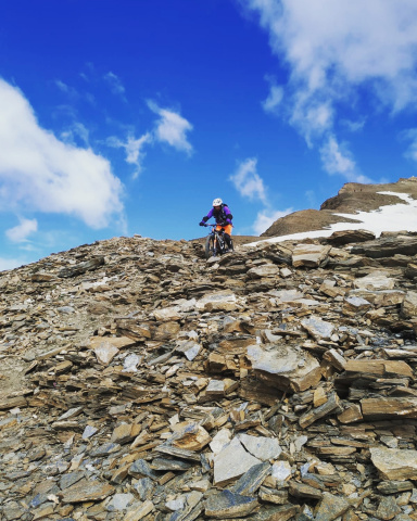
We then resume the ascent, which in about fifty minutes (almost all by pushing and shouldering) takes us to Bocchetta di Strino, 2848 meters, and turning left to the hump above, 2880 meters. Here it is easy to encounter some ibex. If desired in about half an hour it is possible to reach the summit of Redival, 2973 meters (1°; F+).
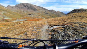
After a suitable break, to rest and admire the amazing view, we begin the libidinous descent. From the summit, except for about 20 meters, it is all doable on pedals. At the fork after the lakes we turn left, descending along a beautiful winding trail (here and there a few short, overgrown sections we overcome by standing on the edges). After a nothing of ascent, at an altitude of 2220 meters, we turn left at a first fork, continuing playfully downhill to an altitude of 2100, where at a further fork (be careful not to get too carried away with the fun) we turn right (signs for Passo del Tonale).
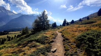
Now begins a long, beautiful traverse on pine-needle trail, virtually all pedalable (BEWARE of an EXPOSED section). Everything flows well (only 4 steps uphill) until a hairpin bend and some steps downhill (CAUTION to the hairpin bend and the last very high steps, high risk of tipping over) that herald the arrival at the Austrian fort Zaccarana (worth a break). We continue again for a long traverse, still on beautiful, cyclable, relaxing path, until we come out on a dirt road that, in a short time takes us back to the starting point
18 km; D+ 1200 m; about 6 hours.