Italiano
 Deutsch
Cima Casaiole, Monte Tonale Occidentale e Bocchetta Bleis
Amazing, unprecedented cycle-mountaineering loop concatenating two nearby peaks, destined to become a gem of its kind in the upper Camonica Valley. High-mountain environment and superlative views of the mountains of the Ortles group, Adamello-Presanella, Great War fortifications and a long, challenging descent to knock your socks off. Tour suitable for cycle mountaineering enthusiasts with fairly challenging backcountry bike sections, some exposed sections. Recommended full bike, enduro - AM type, not suitable for ebikes.
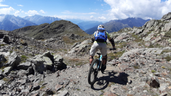
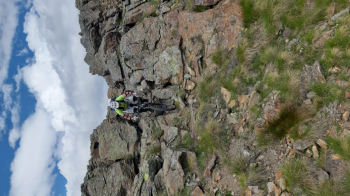
Departure from Ponte di Legno, at the parking lot of the ski lifts, we head towards the center of the village and then reach the old Tonalina road. There are two ways to reach it: the first by walking along Via C. Battisti reach the Ponte Hydroelectric Plant, where a very steep mule track (push) begins; the second, decidedly less traumatic, through Via Villini reaches the Tonale state road, climbing it up to the third hairpin bend, where the Tonalina begins. Reaching the beautiful hamlet of Case di Viso, you climb the classic route up to Rifugio Bozzi at Montozzo. Just before the hut you turn right, taking the path that leads to Passo dei Contrabbandieri, 2661 meters (push and shoulder sections). At the pass, go right up the rocky northern ridge of Cima Casaiole, 2783 m (with bike on shoulder).
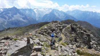
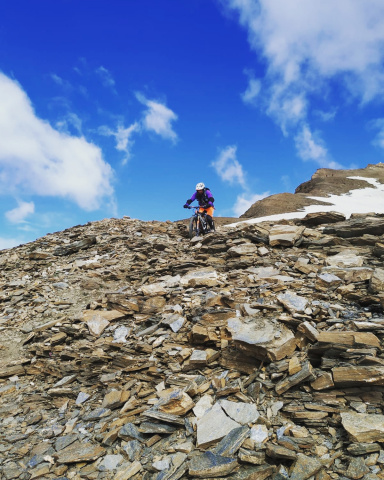
From the summit, after admiring the view and military artifacts, change gear and prepare for the first part of the descent. It is definitely exciting but not well marked, it has to be searched a bit by logic and following the gpx track. Further down you enter the granite and need to take a few steps on foot. Getting back on the pedals you reach a wide grassy saddle. Staying initially to the left of the ridge you pedal a little but then take it briefly to an unnamed peak that barely exceeds 2700 meters. Now begins a very nice section, at first downhill, then slightly uphill leading below the summit of Cima Tonale Occidentale, 2694 meters.
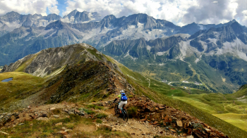
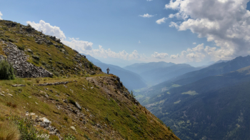
Shortly reaching the summit pushing begins the second downhill section. Initially follow the SE ridge, looking for passages between military artifacts, to about 2550 meters, then turn right along a trail that descends the slope towards the Bleis pond. Keeping the pond on the left now, descend briefly along a track parallel to the ski slope. Keeping to the right, you reach a beautiful grass-bottomed trail bordered by a dry-stone defensive wall.
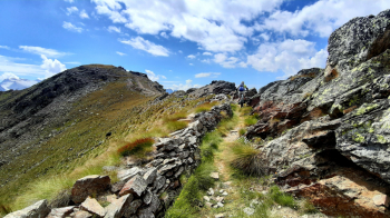
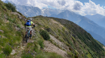
Pedaling uphill you reach the Bocchetta di Bleis at 2450 meters. From here you traverse onto an amazing, long, exposed (CAUTION!) but not particularly difficult path called the Cima Le Sorti trail. Below, far below, runs the more famous Camos, which you will reach with a few hairpin bends at the point where it begins to descend, You follow the fun Camos to a junction at about 2080 elevation at the point where it begins to climb above Tonale. Keeping to the right in the grass, another really fun trail begins that goes into the woods and ends at the small hamlet of Vescasa Alta. At the center of the hamlet turn left to take the last path before the short final gippabile that ends at the first houses of Ponte di Legno. Follow the bike path back to the starting point.