Italiano
 Deutsch
Dal passo Gavia verso il Tibet

We present a spectacular riding tour of the Valcamonica and Valtellina valleys, with a passage through the Alpe Valley, or rather the Tibet of Valtellina.
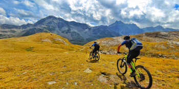
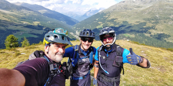
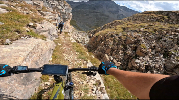
The departure is from Santa Apollonia in the province of Brescia. We go up on asphalt along the classic road to the Gavia Pass and then the Bonetta refuge. Time to catch our breath and we will see Lake Bianco on our right. Be very careful that just after the lake, a newly completed trail begins that will take us towards Pian Bormino. From this point it will be pure Freeride with up&down, streams, waterfalls and a passage into the immensely fantastic Canyon. We pass the Baitina dei Pastori and with a last effort we reach Dosso Tresero.
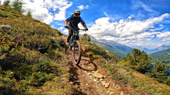
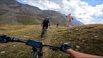
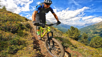
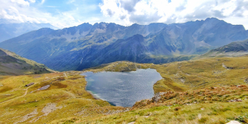
Now we prepare for the first descent, THE ROMANTIC, which will not be fast but will definitely be challenging as we will have to face several switchbacks where nosepresses are very welcome. Initially in sunshine and then in undergrowth it will lead you down to Santa Caterina Valfurva, a beautiful location. Now we have several options. Either we go up the Gavia on asphalt, or we go up the towards the Sunny Valley on tremendous hard climbing on ski slope service roads. In our case my advice, if you want, is to take the lift that will take you in about 15 minutes to the Alpe Valley, just above Sunny Valley. Here your eyes will be filled with wonder as you admire a moonscape, or rather Valtellina Tibet.
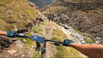
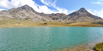
We descend into the valley on a freeride trail, SUNNY VALLEY, among bridges, streams and pure magic-a paradise for us bikers. In this section there are several spots with very crunchy crumbles where you will let your mtb slide and regain your strength before the last ascent. Once you reach the asphalt road that climbs toward the Gavia, it's back to climbing. It will be only about 250 m of elevation gain: take it philosophically because the hard part will come soon. Having reached the Gavia Pass again, we descend on asphalt for about 2 to 3 minutes to the junction with Lago Nero. We turn right and now admire the lake, lapping its left side. Last meters and we are there: the GALLO TRAIL begins. No messing around here guys. There are no overhangs or extreme points but just Hard Rock and Crumble a go go. It will be challenging but believe me all to be experienced to the full while admiring the beauty of the Messi Valley in this area as well. Arriving at the final dirt road we will ride back to Santa Apollonia where we can finally grab a beer and enjoy an infinitely exciting tour.
RECOMMENDED ROUTE FOR MOUNTAIN BIKE and/or E-BIKE ALL MOUNTAIN.
NB: At the time of inclusion this tour is all doable without any particular problems. We disclaim any responsibility for any inconvenience due to lack of maintenance of the trails or deterioration of the same due to external and/or natural agents and a wrong assessment of the tour.