Italiano
 Deutsch
Punta di Ercavallo 3058
Brescian cycle-mountaineering route of refined quality.
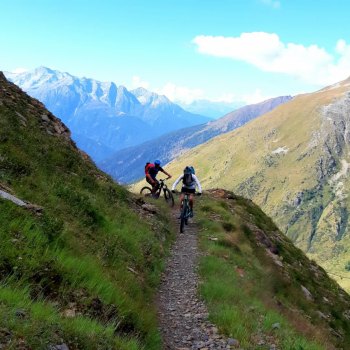
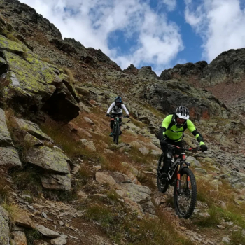
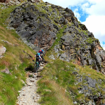
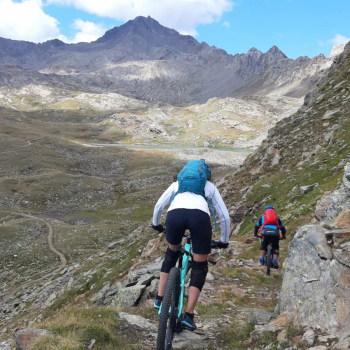
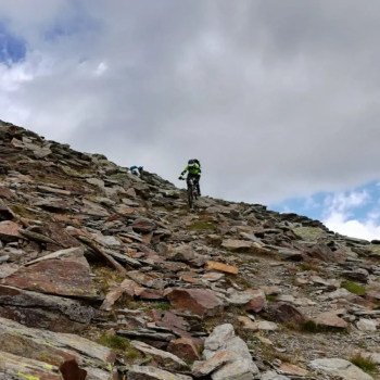
Departure from Pezzo, a hamlet of Ponte di Legno, in the direction of Case di Viso. We admire the beautiful alpine hamlet from above, continuing to the small lake of Viso (five minutes on the shoulder). At the picnic area we resume the classic ascent to Montozzo. From the Bozzi refuge, following the signs for the Ercavallo lakes, we pedal on the beautiful traverse with exposed sections. The pedaling is interrupted several times by short passages on a landslide where, although without any particular difficulty, care must be taken. At the first fork, not far from the lakes, we turn right, climbing, bike on shoulder on mixed grassy and rocky terrain, being careful not to get off the track. As we climb, the plant world disappears, giving way completely to the mineral world. At an elevation of about 2950, when the slope becomes decidedly steep, stony we leave the bike (you could get to the ridge at 3000 meters but still the descent removed a few meters here and there would be on foot.
In short, keeping to the right, following the tracks, among the ruins of military posts from the Great War we reach the main summit at an altitude of 3068.
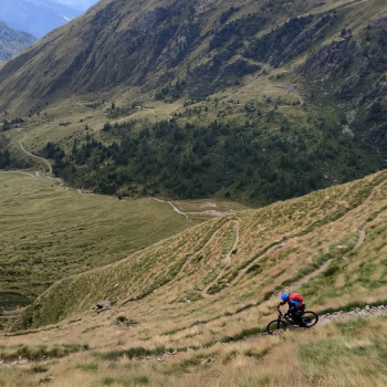
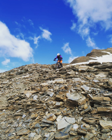
Back on the bikes the playful part begins. The descent, except for a few passages and a ten-meter stretch is totally doable on the pedals, is technical, crunchy, a little physical, great fun.
At about elevation 2640 attention must be paid to a junction, where we turn right. Shortly the trail ends on the mule track leading to the lakes. Having passed the fork in the trail that descends to Case di Viso we continue for another 10 minutes until we reach and admire the charming alpine lakes. Here we could continue to Graole Pass (m 2800) and make the classic descent back to Pezzo. We retrace our steps for a very short distance until we take a short trail to the left that leads to the fork mentioned above.
We now descend along the beautiful trail, not particularly difficult but with long exposed sections where you cannot go wrong (I personally find it more rewarding than the Graole). The highly satisfying descent ends at the Houses where an ice-cold beer awaits us at the only inn in the old hamlet. Finally, with a toothy grin we prepare to make a trivial return to Pezzo along the road (if you wish, you can go back up to take the high trail).