HOME RANKINGS CHALLENGES ROUTES NEAR ME PLANNING SEARCH LOGIN
Italy - Piemonte, TO
2023/08/14 16:34:15

Monte Jafferau, diga di Rochemolles

15 Downloads
0
 
Share

Key Takeaways / Scheda Tecnica

Disciplina:
Mountain Bike (MTB)
Percorso:
Monte Jafferau, diga di Rochemolles
Località:
Italy - Piemonte, TO
Distanza:
80,93 km
Dislivello Positivo:
+2 150 mt (Quota Min: 1019m - Max: 2812m)
Difficoltà Tecnica:
2/5
Valutazione Panorami:
5/5
Formato Traccia:
GPX Download disponibile
Author
pozzoligio
(93)
Place
Italy - Piemonte, TO
Km
80,93 km
Elapsed time
07:33:25
Vertical meters
+2 150 mt (1019 - 2812)
Route difficulty
Landscapes
Last update
2023/08/14 16:51:13
Comments
0
Description

Classic tour in upper Valsusa with arrival at the summit of Mount Jafferau at 2805 meters with descent to Rochemolles Dam. Departure from Salbetrand on the state road, then left to Eclause, asphalt to Moncellier and then on dirt road with 13% gradient to Pramand.

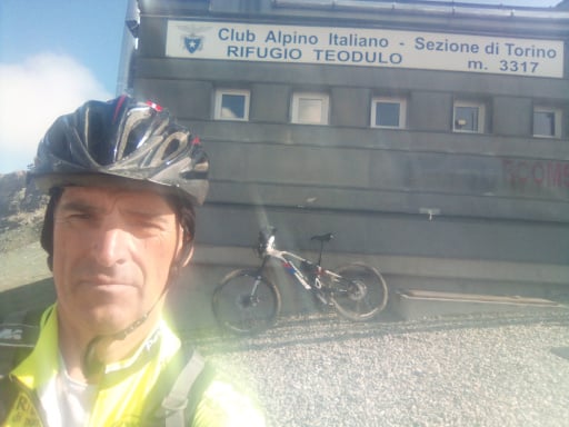
Foto itinerario MTB Monte Jafferau, diga di Rochemolles - Italy - Piemonte, TO

Those who wish climb to the fort and descend again. Now slightly uphill stretch to Saracen tunnel, not lit: 500 exciting meters in smartphone lightFoto itinerario MTB Monte Jafferau, diga di Rochemolles - Italy - Piemonte, TO

Nice view after the tunnel:

Foto itinerario MTB Monte Jafferau, diga di Rochemolles - Italy - Piemonte, TO

Continue uphill to the pass, then flat section with a view of the fort.

Foto itinerario MTB Monte Jafferau, diga di Rochemolles - Italy - Piemonte, TO

As a reminder that the road is open to traffic, especially motorcycles, here is a photo of the summit above the fort.

Foto itinerario MTB Monte Jafferau, diga di Rochemolles - Italy - Piemonte, TO

and the Vallefredda

Foto itinerario MTB Monte Jafferau, diga di Rochemolles - Italy - Piemonte, TO

Now turn back and descend to the large ENEL water tanks. I do not recommend the descent to Vallefredda, half is done on foot but it is shortened. Now long flat section and short climb to the dam which you go around.

Foto itinerario MTB Monte Jafferau, diga di Rochemolles - Italy - Piemonte, TO

Now short trail a bit challenging but short, then dirt road to downhill road to Bardonecchia, then cross a small bridge and follow the nice dirt road to Oulx which is the cross-country trail.

Tour technically very easy but long and physically demanding.

Download our free mobile app to send this route to your Garmin device or to navigate it on OSM maps. Android - iOS
Local weather
Mar 00:00
11 °C
Mar 12:00
10 °C
Mer 00:00
10 °C
Mer 12:00
15 °C
Gio 00:00
6 °C
Gio 12:00
12 °C
Ven 00:00
7 °C
Ven 12:00
8 °C
Sab 00:00
6 °C
Sab 12:00
8 °C

Graph

Nearest Routes

61,32 km
Km
+2 620 mt
Vertical meters
Route difficulty
Landscapes
2023/10/06
- Italy - Piemonte, TO
pozzoligio
(93)
68,38 km
Km
+2 000 mt
Vertical meters
Route difficulty
Landscapes
62,88 km
Km
+2 500 mt
Vertical meters
Route difficulty
Landscapes
2023/10/06
- Italy - Piemonte, TO
pozzoligio
(93)
70,85 km
Km
+2 600 mt
Vertical meters
Route difficulty
Landscapes
2022/11/05
- Italy - Piemonte, TO
gmzolenart
(137)
25,01 km
Km
+1 177 mt
Vertical meters
Route difficulty
Landscapes
2026/06/08
- Italy - Piemonte, TO
Staff
(110)
29,44 km
Km
+1 640 mt
Vertical meters
Route difficulty
Landscapes
2025/10/05
- Italy - Piemonte, TO
33,59 km
Km
+1 300 mt
Vertical meters
Route difficulty
Landscapes
2025/11/01
- Italy - Piemonte, TO
42,50 km
Km
0 mt
Vertical meters
Route difficulty
Landscapes
2022/09/27
- Italy - Piemonte, TO
pozzoligio
(93)
58,96 km
Km
+2 119 mt
Vertical meters
Route difficulty
Landscapes
2023/09/02
- Italy - Piemonte, TO
gmzolenart
(137)
23,62 km
Km
+1 080 mt
Vertical meters
Route difficulty
Landscapes

0 Comments