
 Italiano
 Deutsch
2023/03/01 11:02:05
Sentieri della bassa val Passiria
Author

Place
Italy - Trentino-Alto Adige/Südtirol, BZ
Km
53,70 km
Elapsed time
05:54:23
Vertical meters
+1 570 mt (298 - 860)
Route difficulty
Landscapes
Last update
2023/03/01 17:18:28
Comments
Hotels
Description
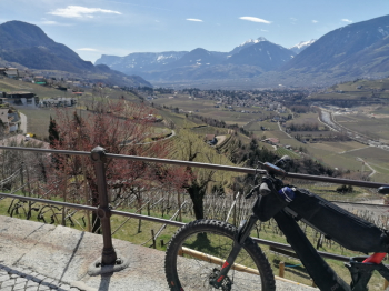
Challenging but very enjoyable and scenic route from Merano to Gomion in Val Passiria taking advantage of all the low-elevation trails.
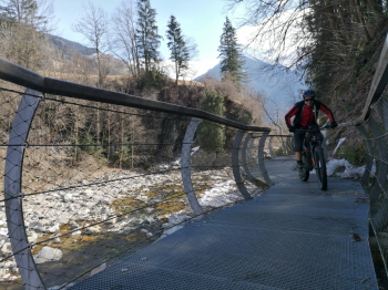
You go up pedaling on the orographic right bank of the Passirio, with lots of up and down, also quite steep, and a couple of pushing sections. You then return to the opposite side of the valley with still many fun trails.
Local weather
Thu 00:00

21 °C
Thu 12:00

29 °C
Fri 00:00

25 °C
Fri 12:00
27 °C
Sat 00:00

23 °C
Sat 12:00
31 °C
Graph
Nearest Routes
2025/11/20
- Italy - Trentino-Alto Adige/Südtirol, BZ 56,93 km
Km
+2 600 mt
Vertical meters
Route difficulty
Landscapes
74,74 km
Km
+2 200 mt
Vertical meters
Route difficulty
Landscapes
29,33 km
Km
+1 650 mt
Vertical meters
Route difficulty
Landscapes
2024/09/18
- Italy - Trentino-Alto Adige/Südtirol, BZ 59,35 km
Km
+3 050 mt
Vertical meters
Route difficulty
Landscapes
61,03 km
Km
+2 156 mt
Vertical meters
Route difficulty
Landscapes
63,04 km
Km
+3 100 mt
Vertical meters
Route difficulty
Landscapes
64,32 km
Km
+2 400 mt
Vertical meters
Route difficulty
Landscapes
41,95 km
Km
+1 783 mt
Vertical meters
Route difficulty
Landscapes
35,55 km
Km
+1 500 mt
Vertical meters
Route difficulty
Landscapes