HOME RANKINGS CHALLENGES ROUTES NEAR ME PLANNING SEARCH LOGIN
Italy - Trentino-Alto Adige/Südtirol, BZ
2025/11/20 09:36:48

Giro dei rifugi di Merano 2000 (antiorario)

1 Downloads
0
 
Share
Author
nonnocarb
(319)
Place
Italy - Trentino-Alto Adige/Südtirol, BZ
Km
56,93 km
Elapsed time
05:14:16
Vertical meters
+2 600 mt (307 - 2351)
Route difficulty
Landscapes
Last update
2025/11/20 09:44:24
Comments
0
Description

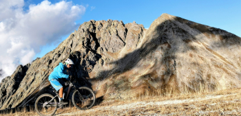
Very challenging tour, especially for the difference in altitude and the gradient of the climbs, but also very enjoyable and scenic.

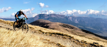
Starting from Avelengo you naturally reduce the elevation gain and climb first to the Maia hut, then to the Oettenbacheralm with beautiful views of the Dolomites. From here you climb with rather hard ramps to the Mittager hut, then with a nice trail to the Valcanova Kesselberg hut.

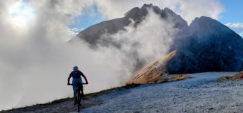
You descend on a nice ridge and climb hard to the Kuhleiten hut with beautiful views.

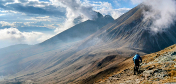
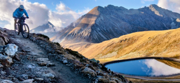
From here endless descent from more than 2000 meters to Merano, via Waidmann Alm, Piffinger and Zuegg hut, then Falzeben, St. Catherine's church and down to Merano.

The tour is designed to be all rideable by ebike and with few technical passages, those who want can of course add various trails, especially on the last descent to Merano.

Download our free mobile app to send this route to your Garmin device or to navigate it on OSM maps. Android - iOS
Local weather
Fri 00:00
17 °C
Fri 12:00
20 °C
Sat 00:00
17 °C
Sat 12:00
21 °C
Sun 00:00
16 °C
Sun 12:00
23 °C
Mon 00:00
17 °C
Mon 12:00
22 °C
Tue 00:00
19 °C
Tue 12:00
24 °C

Graph

Nearest Routes

2024/10/10
- Italy - Trentino-Alto Adige/Südtirol, BZ
Staff
(108)
29,33 km
Km
+1 650 mt
Vertical meters
Route difficulty
Landscapes
2024/09/18
- Italy - Trentino-Alto Adige/Südtirol, BZ
nonnocarb
(319)
59,35 km
Km
+3 050 mt
Vertical meters
Route difficulty
Landscapes
2022/11/21
- Italy - Trentino-Alto Adige/Südtirol, BZ
nonnocarb
(319)
41,95 km
Km
+1 783 mt
Vertical meters
Route difficulty
Landscapes
2024/12/01
- Italy - Trentino-Alto Adige/Südtirol, BZ
Staff
(108)
35,55 km
Km
+1 500 mt
Vertical meters
Route difficulty
Landscapes
2023/03/07
- Italy - Trentino-Alto Adige/Südtirol, BZ
nonnocarb
(319)
33,38 km
Km
+1 600 mt
Vertical meters
Route difficulty
Landscapes
2022/10/22
- Italy - Trentino-Alto Adige/Südtirol, BZ
nonnocarb
(319)
65,78 km
Km
+2 336 mt
Vertical meters
Route difficulty
Landscapes
2025/11/21
- Italy - Trentino-Alto Adige/Südtirol, BZ
nonnocarb
(319)
66,13 km
Km
+2 000 mt
Vertical meters
Route difficulty
Landscapes
2023/03/05
- Italy - Trentino-Alto Adige/Südtirol, BZ
nonnocarb
(319)
93,54 km
Km
+2 520 mt
Vertical meters
Route difficulty
Landscapes
2023/03/01
- Italy - Trentino-Alto Adige/Südtirol, BZ
nonnocarb
(319)
53,70 km
Km
+1 570 mt
Vertical meters
Route difficulty
Landscapes
2025/11/09
- Italy - Trentino-Alto Adige/Südtirol, BZ
nonnocarb
(319)
74,74 km
Km
+2 200 mt
Vertical meters
Route difficulty
Landscapes

0 Comments