
 Italiano
 Deutsch
2026/04/09 08:17:29
Parcines 3000
Author

Place
Italy - Trentino-Alto Adige/Südtirol, BZ
Km
63,04 km
Elapsed time
06:02:28
Vertical meters
+3 100 mt (301 - 1588)
Route difficulty
Landscapes
Last update
2026/04/09 18:04:37
Comments
Hotels
Description
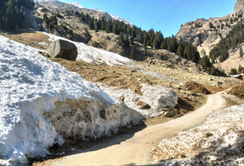
A route that takes you on a journey to discover every single farmstead and mountain hut in the Parcines Valley.
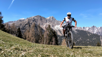
In doing so, you’ll cover a total elevation gain of 3,000 meters.
The ride is truly challenging, not so much for the technical difficulty but for the elevation gain and the steepness of the climbs, all ranging from 16% to 24%.
This makes it the perfect route for an e-bike; if you can complete it in one go, it will take just a few hours, otherwise you can stop at one of the many mountain huts to eat and recharge your battery.
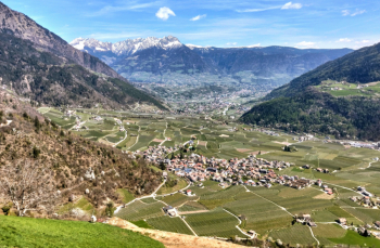
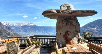
The views are stunning. If you have good technical skills, for the descents you can take one of the many trails that cut through the hairpin turns.
Local weather
Thu 00:00

21 °C
Thu 12:00

29 °C
Fri 00:00

26 °C
Fri 12:00

26 °C
Sat 00:00
20 °C
Sat 12:00
29 °C
Graph
Nearest Routes
74,74 km
Km
+2 200 mt
Vertical meters
Route difficulty
Landscapes
53,70 km
Km
+1 570 mt
Vertical meters
Route difficulty
Landscapes
74,92 km
Km
+2 500 mt
Vertical meters
Route difficulty
Landscapes
61,04 km
Km
+2 300 mt
Vertical meters
Route difficulty
Landscapes
65,78 km
Km
+2 336 mt
Vertical meters
Route difficulty
Landscapes
41,95 km
Km
+1 783 mt
Vertical meters
Route difficulty
Landscapes
64,04 km
Km
+2 200 mt
Vertical meters
Route difficulty
Landscapes
2025/11/21
- Italy - Trentino-Alto Adige/Südtirol, BZ 66,13 km
Km
+2 000 mt
Vertical meters
Route difficulty
Landscapes
64,32 km
Km
+2 400 mt
Vertical meters
Route difficulty
Landscapes