HOME RANKINGS CHALLENGES ROUTES NEAR ME PLANNING SEARCH LOGIN
Italy - Trentino-Alto Adige/Südtirol, BZ
2024/07/26 16:29:30

Merano highline senso orario

26 Downloads
0
 
Share

Key Takeaways / Scheda Tecnica

Disciplina:
Mountain Bike (MTB)
Percorso:
Merano highline senso orario
Località:
Italy - Trentino-Alto Adige/Südtirol, BZ
Distanza:
64,32 km
Dislivello Positivo:
+2 400 mt (Quota Min: 232m - Max: 1837m)
Difficoltà Tecnica:
4/5
Valutazione Panorami:
3/5
Formato Traccia:
GPX Download disponibile
Author
nonnocarb
(324)
Place
Italy - Trentino-Alto Adige/Südtirol, BZ
Km
64,32 km
Elapsed time
06:06:53
Vertical meters
+2 400 mt (232 - 1837)
Route difficulty
Landscapes
Last update
2024/07/26 22:21:27
Comments
0
Description

Merano highline is a beautiful 18 km route always at high altitude, from 1500 to 1900 meters, above the Venosta valley.
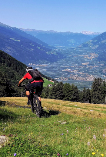
Foto itinerario MTB Merano highline senso orario - Italy - Trentino-Alto Adige/Südtirol, BZ

It passes largely on the Vinschgau alpine hut route, in fact along the way there are many alpine huts where you can eat, rest and enjoy the fantastic view of the 3000+ meter high peaks!
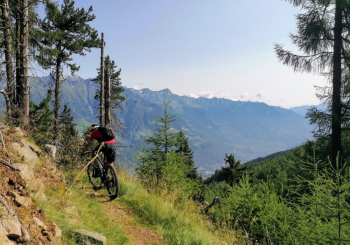
Foto itinerario MTB Merano highline senso orario - Italy - Trentino-Alto Adige/Südtirol, BZ

It can be done both ways, this time I did it clockwise and from Merano it is 65 km and almost 2500 meters of elevation gain, with beautiful climbing mostly on trails (for e-bikes only).
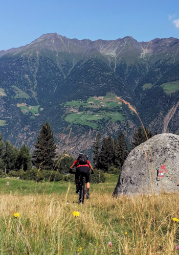
Foto itinerario MTB Merano highline senso orario - Italy - Trentino-Alto Adige/Südtirol, BZ

For the less trained, just take the cable car from San Vigilio or even better from Aschbach to save about 1000 meters of elevation gain.
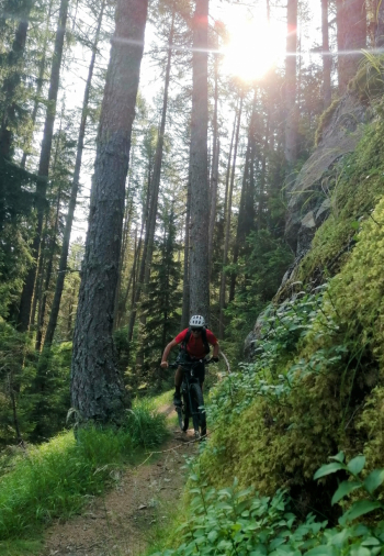
Foto itinerario MTB Merano highline senso orario - Italy - Trentino-Alto Adige/Südtirol, BZ

If, on the other hand, you want to take a shorter ride, just descend from one of the beautiful nature trails set up especially for bikes, such as Oetzi trail, Lupo Trail and others, where the very simple rule of "Trail tolerance" between bikers and pedestrians applies, which should be enforced everywhere and no bans would be needed!
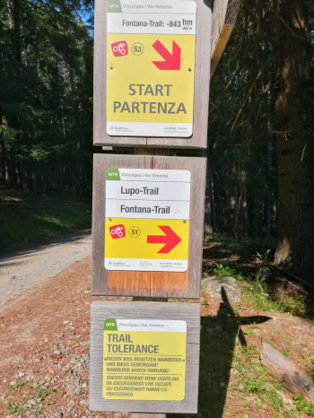
Foto itinerario MTB Merano highline senso orario - Italy - Trentino-Alto Adige/Südtirol, BZ

Download our free mobile app to send this route to your Garmin device or to navigate it on OSM maps. Android - iOS
Local weather
Tue 00:00
15 °C
Tue 12:00
17 °C
Wed 00:00
15 °C
Wed 12:00
14 °C
Thu 00:00
13 °C
Thu 12:00
15 °C
Fri 00:00
10 °C
Fri 12:00
12 °C
Sat 00:00
10 °C
Sat 12:00
13 °C

Graph

Nearest Routes

2023/03/05
- Italy - Trentino-Alto Adige/Südtirol, BZ
nonnocarb
(324)
85,71 km
Km
+2 730 mt
Vertical meters
Route difficulty
Landscapes
2023/03/01
- Italy - Trentino-Alto Adige/Südtirol, BZ
nonnocarb
(324)
61,03 km
Km
+2 156 mt
Vertical meters
Route difficulty
Landscapes
2023/03/04
- Italy - Trentino-Alto Adige/Südtirol, BZ
nonnocarb
(324)
58,50 km
Km
+1 370 mt
Vertical meters
Route difficulty
Landscapes
2023/03/01
- Italy - Trentino-Alto Adige/Südtirol, BZ
nonnocarb
(324)
53,70 km
Km
+1 570 mt
Vertical meters
Route difficulty
Landscapes
2022/11/01
- Italy - Trentino-Alto Adige/Südtirol, BZ
nonnocarb
(324)
42,55 km
Km
+2 157 mt
Vertical meters
Route difficulty
Landscapes
2026/08/20
- Italy - Trentino-Alto Adige/Südtirol, BZ
nonnocarb
(324)
73,40 km
Km
+3 000 mt
Vertical meters
Route difficulty
Landscapes
2022/10/28
- Italy - Trentino-Alto Adige/Südtirol, BZ
nonnocarb
(324)
52,87 km
Km
+1 754 mt
Vertical meters
Route difficulty
Landscapes
2024/10/10
- Italy - Trentino-Alto Adige/Südtirol, BZ
Staff
(110)
29,33 km
Km
+1 650 mt
Vertical meters
Route difficulty
Landscapes
2026/04/09
- Italy - Trentino-Alto Adige/Südtirol, BZ
nonnocarb
(324)
63,04 km
Km
+3 100 mt
Vertical meters
Route difficulty
Landscapes
2025/11/20
- Italy - Trentino-Alto Adige/Südtirol, BZ
nonnocarb
(324)
56,93 km
Km
+2 600 mt
Vertical meters
Route difficulty
Landscapes

0 Comments