
 Italiano
 Deutsch
Anello Ramaceto

Short but not to be underestimated loop itinerary.
The departure is from Ventarola, a hamlet of the municipality of Rezzoaglio, the trail starts from the parking lot at the entrance of the village where you can leave your car.
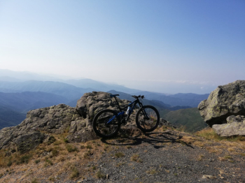
Set off and head toward the village, as you cross it on the right there is a fountain where you can fill your water bottles. Cross the stream and follow the dirt road, at the first fork take a left crossing the stream again. Continuing you will come to a large meadow, take the dirt road to the right where there is a fenced picnic area. Now the road begins to climb and crosses the stream several times, which is nothing more than the initial part of the Aveto that flows into the Trebbia downstream. After one of these crossings follow to the right, the dirt road becomes bumpier and the cyclability suffers. You thus arrive at Bocca di Feia, you notice because you come out of the woods and the view begins to open up, here turn left for the last challenging ramp that will lead you by the chapel of Mount Ramaceto. If the day assists you and there is no haze the view sweeps 360°, unfortunately on the day of the photo it was very humid and you can't see well, but that is the Sestri Levante peninsula at the bottom.
Follow the whole ridge of Ramaceto, again not all cyclable, until you reach a fork, take the path on the left that takes you back inland, here begins the descent, very technical but all cyclable with a minimum of experience. At the end of the trail follow the dirt road downhill to the Crocetta pass, where you take the dirt road downhill to the left that rejoins the trail you followed earlier, following the same road you will return first to Ventarola and then to the parking lot.
The difficulty is 4 stars despite the short length due to the presence of some shoulder bike sections and the technical descent.


