
 Italiano
 Deutsch
Gran Tour del Montozzo

Epic itinerary of great satisfaction, challenging and technically complete, recommended for trained and experienced bikers. We are in the Stelvio National Park with spectacular views: from the glaciers of Adamello- Presanella and San Matteo, to the wide panoramas of the Pezzo and Peio valleys, from the high altitude grasslands (we reach 2613 meters) to the forests and alpine lakes, from the artifacts of the First World War to the characteristic rural mountain buildings.
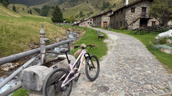
Leaving your car in Pontedilegno, in the parking lot in front of the funicular, you enter the Pezzo valley and continue in the direction of the magnificent alpine pasture of Case di Viso (1,750 meters), initially passing on the Tonale Pass road.
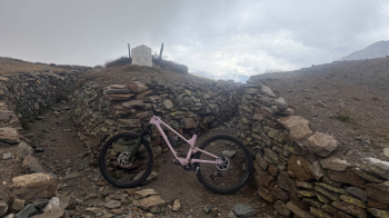
You immediately begin to toil with a challenging, but beautiful, dirt road that leads to the 2,500-meter Rifugio Bozzi (a restorative break is in order).
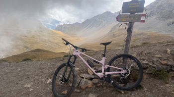
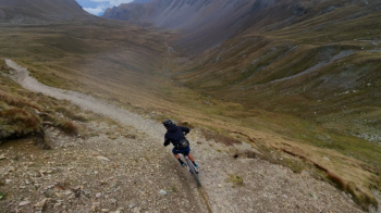
There are about 100 meters of elevation gain left, to be covered on a steep road with a bumpy surface (rideable only with the ebike), to reach the highest point of our itinerary: the Forcella di Montozzo, 2,613 meters above sea level.
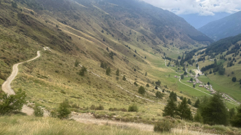
After long exertions it is finally time for a spectacular single track, one of the best we have faced so far, which will accompany us all the way down to Val di Pejo. Initially the descent is very flowing and you can let the bike run.
Later it becomes more rocky but almost all doable in the saddle.
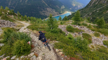
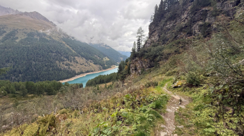
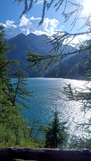
It is 21 km of descent, beware though that the phone gets almost no reception, I would say a nice S2 with a few S3 passages. The first part is on typical alpine flow trail with rocky sections, the second part, as you enter the woods, is a bit more technical and there are many switchbacks. When you get to the end of the trail, you arrive at the dam with beautiful emerald-colored water.
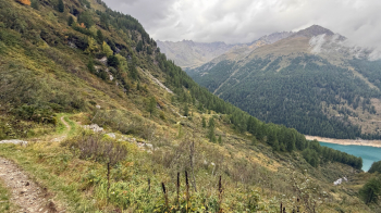
The trail, once you get to Fontanino, continues on the path on the orographic right of the creek. It is a new trail, with lots of ups and downs and lots of roots, which at one point allows you to return to the paved road. The trail continues straight on to a fort, with a steep pushing section. The fort is above Pejo and worth a visit, but if you don't want to push your bike, take the asphalt. The descent continues on an old military road, the one that led to the fort, until we return to the asphalt road and descend to Pejo Fonti. From here we unfortunately have to continue on asphalt, except for a small cut before Cogolo. Short section on road open to traffic, before taking the bicycle path that takes us to Fucine.
From here another bike path in the direction of Vermiglio, and then continue, always away from traffic, true Tonale, until we join a pleasant military road, with moderate and regular gradient until we reach the long-awaited Pass (1,890 meters).
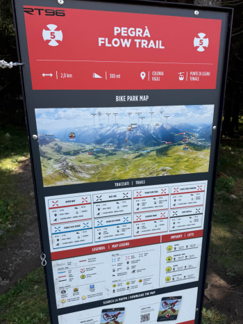
Here begins the descent to Pontedilegno, if you are exhausted you can opt for the Oglio bike path, but nè definitely better to descend from the very fun and not too technical bikepark track that will accompany you to the car.
Itinerary also contains text and photos by robibz and Marco, track updated September 12, 2025.


