Italiano
 Deutsch
La Punt - Capanna Kesch - Albula - La Punt

Kesch-Hütte & Albula Pass Tour: An Epic Loop in the Upper Engadine.
A majestic and challenging high-altitude route that requires excellent physical conditioning and strong technical riding skills. Lunar landscapes, rocky singletrack, flowing descents through the woods, and two historic Alpine passes all wrapped up in a single, unforgettable loop.
The Approach and Val Susauna: The ride begins in La Punt, warming up your legs along the valley bike path toward Zuoz and S-chanf. A few kilometers past the village, you leave the valley floor behind, turning left to enter the picturesque Val Susauna. The climb begins gently on an easy dirt road, but don’t be fooled: the gradients soon become steep, with sharp inclines leading up to a splendid high-altitude plateau.
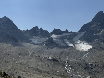
Reaching the Kesch-Hütte (Capanna Kesch): at the fork on the plateau (where keeping right would take you toward the Scalettapass), turn left toward Chamanna Kesch. Here you’ll find a mountain hut, an excellent spot to refill your water supply. From this point on, the trail winds into the heart of the valley, transforming into a fantastic singletrack. Initially, the route features fun ups and downs, but as you climb, the terrain becomes increasingly rocky, technical, and challenging. The last kilometer is a real challenge: the steep slopes and rough terrain require you to push your bike in some sections until you reach the Capanna Kesch at 2,632 meters, overlooking the Porchabella Glacier.
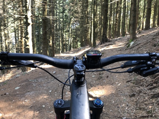
The wild descent toward Bergün: after a well-deserved break to refuel at the mountain hut, the very long descent toward Bergün begins. The first part is very steep and requires excellent brake control and maximum concentration. As you lose elevation, the trail becomes smoother andmore flowing, offering a super fun section through dense larch forests. The final kilometers before entering the village run along a fast dirt road.
Act Two: the Albula Pass: Once you arrive in Bergün, the village offers numerous water fountains and a small supermarket—ideal for buying something to eat and recharging your energy. From here, the day’s second major climb begins toward the Albula Pass. Once you reach the summit of the pass, your effort is instantly rewarded: awaiting you is the beautiful and famous flow trail that will take you on a pure, fun descent, bringing you right back to the starting point in La Punt.
Notes for E-Bikes: The route is also feasible on an E-MTB, but requires careful battery management. You’ll need to carefully assess your battery consumption to ensure you have enough range to tackle the steep climbs of Val Susauna and reach the Capanna Kesch. From the hut onward, it’s all downhill to Bergün: here, if necessary, it’s advisable to stop for a break and a partial recharge before tackling the tough final climb to the Albula Pass.