HOME RANKINGS CHALLENGES ROUTES POI PLANNING SEARCH LOGIN
Switzerland
2023/08/20 17:47:20

Passo Suvretta e Val Bever

2 Downloads
0
 
Author
CrisB
(4)
Place
Switzerland
Km
34,63 km
Elapsed time
02:22:21
Vertical meters
+1 038 mt (1723 - 2636)
Route difficulty
Landscapes
Last update
2023/08/20 17:53:36
Comments
0
Description

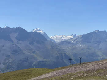
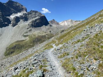
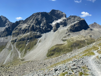
The tour starts at the Celerina station. A gently sloping dirt road allows the first 400 meters of elevation gain to Alp Laret, then becomes steeper: past the Glüna Hut and the Lej Alv, it continues to the Corviglia mountain station at more than 2,400 meters above sea level. There are 200 meters of elevation gain to reach the highest point of the tour, first on a steep dirt road, then on a trail with magnificent views of the Upper Engadine lake region and the Bernina massif, around Piz Nair and up to the Suvretta Pass. From here begins the magnificent trail across Suvretta from Samedan to Alp Suvretta.

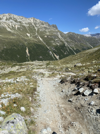
The final section is an alpine trail through the beautiful Val Bever to Spinas. Continue along a pleasant descent to Bever and, skirting the valley floor, return to Celerina.

Download our free mobile app to send this route to your Garmin device or to navigate it on OSM maps. Android - iOS

Graph

Nearest Routes

2023/08/28
- Switzerland
CrisB
(4)
38,27 km
Km
+695 mt
Vertical meters
Route difficulty
Landscapes
2023/07/08
- Italy - Lombardia, SO
14,78 km
Km
+1 118 mt
Vertical meters
Route difficulty
Landscapes
2023/07/08
- Italy - Lombardia, SO
9,07 km
Km
+320 mt
Vertical meters
Route difficulty
Landscapes
2023/10/11
- Italy - Lombardia, SO
23,71 km
Km
+1 100 mt
Vertical meters
Route difficulty
Landscapes
2023/07/11
- Switzerland
marco
(102)
20,11 km
Km
+298 mt
Vertical meters
Route difficulty
Landscapes
2022/09/22
- Italy - Lombardia, SO
54,13 km
Km
+4 005 mt
Vertical meters
Route difficulty
Landscapes
2023/07/13
- Italy - Lombardia, SO
marco
(102)
48,08 km
Km
+100 mt
Vertical meters
Route difficulty
Landscapes
2023/09/02
- Italy - Lombardia, SO
Seraffo85
(13)
17,35 km
Km
+285 mt
Vertical meters
Route difficulty
Landscapes
2022/08/19
- Italy - Lombardia, SO
marco
(102)
46,99 km
Km
+1 121 mt
Vertical meters
Route difficulty
Landscapes
2023/07/06
- Italy - Lombardia, SO
marco
(102)
30,18 km
Km
+1 277 mt
Vertical meters
Route difficulty
Landscapes

0 Comments