HOME RANKINGS CHALLENGES ROUTES NEAR ME PLANNING SEARCH LOGIN
Switzerland
2025/08/24 19:15:16

Da St. Moritz a Livigno e ritorno

6 Downloads
2
 
Share

Key Takeaways / Scheda Tecnica

Disciplina:
Mountain Bike (MTB)
Percorso:
Da St. Moritz a Livigno e ritorno
Località:
Switzerland
Distanza:
89,17 km
Dislivello Positivo:
+2 300 mt (Quota Min: 1651m - Max: 2723m)
Difficoltà Tecnica:
3/5
Valutazione Panorami:
5/5
Formato Traccia:
GPX Download disponibile
Author
CrisB
(5)
Place
Switzerland
Km
89,17 km
Elapsed time
06:08:35
Vertical meters
+2 300 mt (1651 - 2723)
Route difficulty
Landscapes
Last update
2025/08/24 21:27:33
Comments
0
Description

The tour starts from Celerina in the direction of Pontresina along an easy dirt road. From there it continues to Morteratsch, where an initial climb leads from 1900 to 2000 meters with a steep and technical but fun section. Past this passage you continue to Ospizio Bernina (2300 meters), still on a gravel road with a regular gradient. From the Ospizio you go up to Forcola di Livigno (2450 meters) facing some technical but doable sections, especially with e-bikes. From here begins the scenic descent to the 2300-meter Forcola and then to Livigno, with a first winding flow part and then on dirt and gippable roads along the valley.

You reach Alpe Vago (2000 meters) staying initially on the right side of the river and, after a detour (trail 436 or 1), back on the left side to the gates of Livigno. Here you take the bike path, where e-MTB charging stations are available (Italian plug is needed). After a stop, the route resumes on the 444 as it enters the Federia valley, passing by the Calcheira bridge to an elevation of about 2100 meters, then veering right to the Chaschauna Pass (2700 meters). The climb has steep gradients and uneven ground, doable with e-bikes but challenging on bikes.

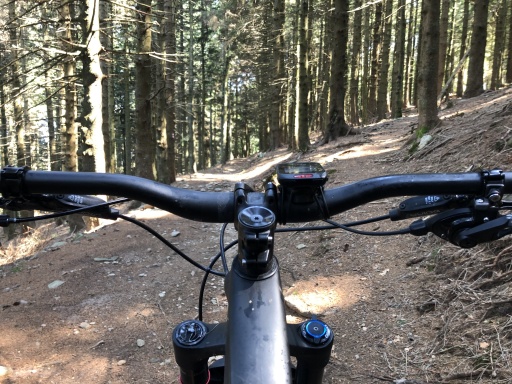
Foto itinerario MTB Da St. Moritz a Livigno e ritorno - Switzerland

From the pass you return to Switzerland by descending down the Chaschauna Valley (trail 444) toward S-Chanf. The first part is flowing and undemanding, followed by a long valley descent through pastures and marmots, still on a smooth road.

Foto itinerario MTB Da St. Moritz a Livigno e ritorno - Switzerland

Foto itinerario MTB Da St. Moritz a Livigno e ritorno - Switzerland

Finally, from S-Chanf you return on a bicycle path toward Celerina.


Download our free mobile app to send this route to your Garmin device or to navigate it on OSM maps. Android - iOS
Local weather
Mar 00:00
5 °C
Mar 12:00
10 °C
Mer 00:00
7 °C
Mer 12:00
8 °C
Gio 00:00
1 °C
Gio 12:00
1 °C
Ven 00:00
1 °C
Ven 12:00
4 °C
Sab 00:00
1 °C
Sab 12:00
1 °C

Graph

Nearest Routes

2023/08/28
- Switzerland
CrisB
(5)
38,27 km
Km
+695 mt
Vertical meters
Route difficulty
Landscapes
2023/08/20
- Switzerland
CrisB
(5)
34,63 km
Km
+1 038 mt
Vertical meters
Route difficulty
Landscapes
2026/08/05
- Switzerland
30,37 km
Km
+1 700 mt
Vertical meters
Route difficulty
Landscapes
77,62 km
Km
+2 267 mt
Vertical meters
Route difficulty
Landscapes
2026/07/18
- Switzerland
avalonice
(8)
30,60 km
Km
+1 150 mt
Vertical meters
Route difficulty
Landscapes
2025/07/20
- Switzerland
miciolo
(55)
29,54 km
Km
+1 300 mt
Vertical meters
Route difficulty
Landscapes
2024/08/12
- Switzerland
Staff
(110)
26,02 km
Km
+1 005 mt
Vertical meters
Route difficulty
Landscapes
2026/08/11
- Switzerland
90,19 km
Km
+3 200 mt
Vertical meters
Route difficulty
Landscapes
2023/07/08
- Italy - Lombardia, SO
14,78 km
Km
+1 118 mt
Vertical meters
Route difficulty
Landscapes
2023/07/08
- Italy - Lombardia, SO
9,07 km
Km
+320 mt
Vertical meters
Route difficulty
Landscapes

0 Comments