Italiano
 Deutsch
Val di Fassa. Monte Aut
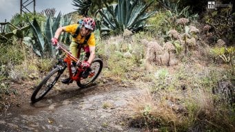
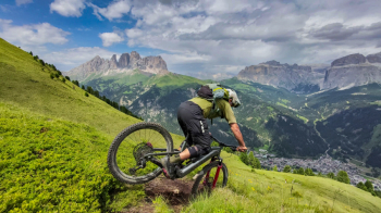
I recommend this ride for anyone looking for an all-mountain experience in Val di Fassa, off the beaten path and away from the most famous and tourist-crowded routes. It’s great for July and August, and if you do it off-season, it becomes even more epic. I started from Pera, parking at the Vajolet chairlift, and my destination was Sella Brunech and the beautiful ridge of Mount Aut, located in the Ciampac basin within the Marmolada massif.
To get there, you’ll need to tackle the tough climb up Val Jumela, but you can skip the first, extremely steep sections by taking an alternative route that starts at the beginning of Val San Nicolò. The first 400–500 meters of elevation gain are “easily” covered thanks to a comfortable forest road and a beautiful trail that offers some fun technical sections.
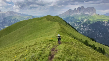
At an elevation of 1,900 meters, the trail intersects with Val Jumela, and from here to the summit of Monte Aut at 2,500 meters, it’s going to be a real struggle. Steep climbs and ski runs will give us a run for our money, but once we reach the summit, an incredible panorama of the entire Dolomites opens up, along with a breathtaking initial descent along the ridge that will leave you speechless.
Be careful: this section is the only part of the entire route where you’ll need to watch out for tourists. In fact, it’s fairly easy to reach thanks to the nearby ski lifts, and although the area isn’t overcrowded, during peak season it’s common to encounter hikers. In this case, since space is limited, you’ll need to stop and yield the right of way. Please be respectful!
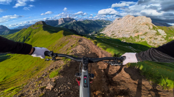
Once the first part of the descent is over, we have two options. The first, perhaps more suited to enduro riding, is to descend along the trail leading to the Ciampac lift and then reconnect with the EWS Titans Trail (Black difficulty). The second option, which is more All-Mountain in style, is the one featured in this route and involves continuing along a high-altitude traverse to reach Mount Pelous. The traverse, which passes beneath Crepa Neigra—famous in the valley for its black volcanic rock—is very narrow; you can ride almost the entire way, but you must be careful not to let your pedals touch the edges.
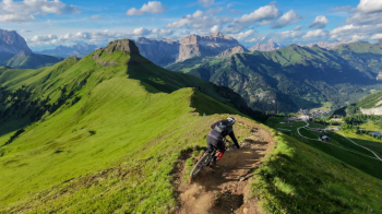
Once you reach Mount Pelous, the real descent begins. The first 100 meters of elevation drop are covered on a trail that plunges down a steep, open meadow—it’s not technical but very steep, so you need to be careful to moderate your speed. Then you enter the woods; the slope levels off, and you start to have fun on the beautiful trail surface of dirt, pine needles, a few roots, and rocky sections. In the final stretch, you descend to Ciasates, another short EWS trail that takes you all the way to Canazei.
From Canazei, to return to the starting point, you can follow the entire bike path; or, if you’re still up for a bit of adrenaline, you can follow the trail for one last climb of 250 meters in elevation gain to reach a trail that will take you directly to the chairlift parking lot.
- For this ride, you can start from any point in the valley between Pera and Canazei.
- The second climb can be avoided.
- The route is almost entirely rideable uphill (apart from a few short sections), whether you’re on a mountain bike or an e-MTB; however, if you choose the former, you’ll need to be in excellent shape to avoid having to push your bike almost the entire time—the climb is very tough.
- The difficulty of the descents is medium to high; for most of their length, they are rated S3 with a few short S4 sections (which can be bypassed on foot), so good technique and experience with alpine trails are required.
- In the Dolomites, hoping not to encounter anyone—especially during peak season—is nearly impossible, so be careful and always yield to pedestrians.
Enjoy the ride!