HOME RANKINGS CHALLENGES ROUTES POI PLANNING SEARCH LOGIN
Italy - Trentino-Alto Adige/Südtirol, TN
2022/10/22 17:25:17

Catinaccio d'Antermoia

59 Downloads
3
 
Author
nonnocarb
(266)
Place
Italy - Trentino-Alto Adige/Südtirol, TN
Km
41,88 km
Elapsed time
06:46:09
Vertical meters
+2 190 mt (1319 - 2754)
Route difficulty
Landscapes
Last update
2022/10/22 17:52:18
Comments
2
Description

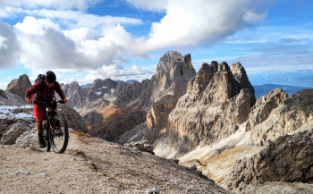
Very challenging and very technical itinerary, but also very fun and very scenic!

From Pera di Fassa climb to Gardeccia, then up very steep forestry to Rif Vajolet and then on trail to Principe Pass. Up to here the route is all pedalable, completely by ebike, with a few pushing sections, depending on training, with regular bike. Now you face the most challenging section, about half an hour up to the Antermoia pass, half pushing and half with the bike on your back. At the pass magnificent panorama.

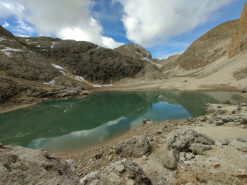
We then descend on a bumpy trail to Lake Antermoia and the hut of the same name.

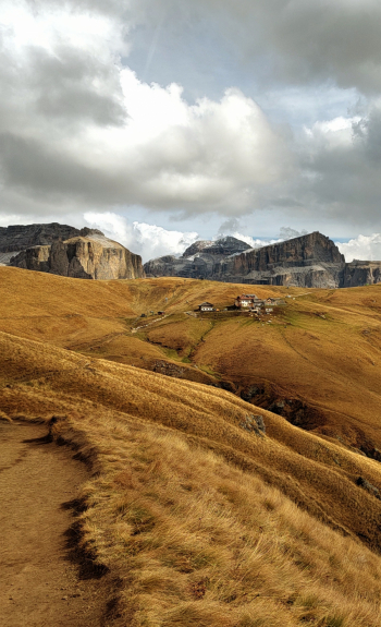
At the Dona pass we have two options, either cut right and descend into the Fassa valley, or go down the very technical trail into the Duron valley. We choose the second option, in the Duron valley we then have to climb up to the Duron pass in order to take the beautiful Federico Augusto trail that, with many up and downs, takes us to Col Rodella. Be careful, this trail is only to be done out of season, due to the many hikers present. Last steep climb to Col Rodella and then challenging but fun descent on the 530 to Canazei.

From here on a slightly downhill bike path back to the starting point. Itinerary not to be done in summer and on weekends!

Download our free mobile app to send this route to your Garmin device or to navigate it on OSM maps. Android - iOS

Graph

Nearest Routes

2022/08/20
- Italy - Trentino-Alto Adige/Südtirol, TN
pozzoligio
(87)
28,10 km
Km
+791 mt
Vertical meters
Route difficulty
Landscapes
2022/08/19
- Italy - Trentino-Alto Adige/Südtirol, TN
pozzoligio
(87)
51,42 km
Km
+2 048 mt
Vertical meters
Route difficulty
Landscapes
2023/02/26
- Italy - Trentino-Alto Adige/Südtirol, TN
nonnocarb
(266)
24,50 km
Km
+1 500 mt
Vertical meters
Route difficulty
Landscapes
2023/07/28
- Italy - Trentino-Alto Adige/Südtirol, TN
pozzoligio
(87)
35,59 km
Km
+1 551 mt
Vertical meters
Route difficulty
Landscapes
2023/07/27
- Italy - Trentino-Alto Adige/Südtirol, TN
pozzoligio
(87)
47,84 km
Km
+2 292 mt
Vertical meters
Route difficulty
Landscapes
2023/07/25
- Italy - Trentino-Alto Adige/Südtirol, TN
pozzoligio
(87)
64,76 km
Km
+2 100 mt
Vertical meters
Route difficulty
Landscapes
2023/07/25
- Italy - Trentino-Alto Adige/Südtirol, TN
pozzoligio
(87)
55,87 km
Km
+1 637 mt
Vertical meters
Route difficulty
Landscapes
2023/03/06
- Italy - Trentino-Alto Adige/Südtirol, TN
nonnocarb
(266)
20,80 km
Km
+1 120 mt
Vertical meters
Route difficulty
Landscapes
2023/08/22
- Italy - Trentino-Alto Adige/Südtirol, TN
Robibz
(19)
38,66 km
Km
+1 695 mt
Vertical meters
Route difficulty
Landscapes
2023/07/27
- Italy - Trentino-Alto Adige/Südtirol, TN
steve-U
(21)
31,96 km
Km
+2 156 mt
Vertical meters
Route difficulty
Landscapes

2 Comments