Italiano
 Deutsch
Villa San Martino Loop MTB

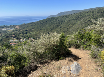
Another great collection of descents around Villa San Martino (Napoleon’s residence on Elba). The route starts in Marina di Campo and follows trails up to the Literno climb, a gradual dirt road with sections of loose gravel; you reach the San Martino junction and continue straight on along the CAI 45 trail. Just before Monte Pericoli, keep to the right and a nice single track begins that descends toward Villa S. Martino (S3); after a rocky section, keep to the right (Suore Trail) and you’ll encounter switchbacks, more technical sections over loose stones and rock, and steps, though it remains very smooth.
At the Villa, continue along the forest road (Cai 121), which climbs with a few short steep sections through the woods (over loose rocks) until reaching a crossroads. The short loop is worth taking; it features a medium-difficulty single track that descends to the start of the forest road. Retrace the forest road, and at the crossroads, continue straight ahead on a gradual single track that climbs up to the GTE. Here, turn right and shortly after left to take the Molino a vento trail, which descends to Lacona. The route starts off flowing but then gets challenging with technical sections over loose rocks and boulders, steep sections, and steps (S3/4). Upon reaching the first houses, turn left to take a nice single-track climb (Colle delle Vacche) that brings you back to the GTE.
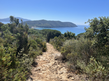
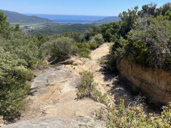
Keep left and continue on the forest road until the junction for the beautiful Serra del Pero trail. This highly technical route needs no introduction—it’s the must-do in the area: rock steps, boulders, steep sections, and a few flowing stretches (S4 with some S5 sections). Once you reach the provincial road to Lacona, climb up the paved road toward the Monumento Pass, and at an elevation of 150 meters, take the dirt road on the left that ascends toward Monte Tambone. The climb is gradual, with a few short steep sections, and then gets tougher when you reach the ridge dirt road (keep to the right). Once you reach Monte Tambone (and the antennas), a short but fun trail begins—now entirely rideable. In fact, near some rock jumps (unrideable on a bike), you can take a path first to the right and then to the left, all of which is easily rideable. In the final stretch, you return to the classic trail with a few technical sections that are well manageable (and a couple of short rideable climbs).
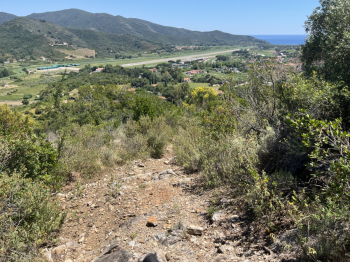
At Passo del Monumento, take the dirt road that climbs, then descends, and then climbs again (keep right) up to San Martino. Here, follow the CAI 45 trail, which passes to the left of Monte Pericoli and descends toward Colle Pecorino. A nice, flowing descent with a few more technical sections in the final part. Cross the provincial road and take the dirt road in front that climbs and then descends until you reach the trail (on the right) for Procchio/Biodola. Keep left toward Procchio: a nice traverse through the woods with some ups and downs leading to the beach at Procchio. Here, head back up onto the provincial road and continue toward Marciana Marina. Just past the village of Redinoce, take CAI 16 to the left, which climbs gradually toward Santa Rita and then turns left toward Colle Reciso (a nice technical climb over rocky terrain).
This final loop is recommended only for “adventure” lovers; in fact, after an initial attempt to explore an old trail that is now impassable (due to vegetation), I returned to Colle Reciso to retrace a trail I had taken a few years ago—a beautiful rocky trail—but even this was heavily overgrown, and I managed to get through with difficulty. It would be worth clearing out because it’s a beautiful, technical descent that’s well worth the effort, leading directly to Pila, and from there, a short ride along bike paths takes you back to Marina di Campo.