Italiano
 Deutsch
Elba Tour Centro

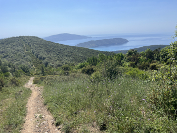
A great collection of descents in the central part of the island of #elba: Marina di Campo, Lacona, Monte Tambone, Viticcio, Enfola, Portoferraio. You leave Marina di Campo and follow trails to reach the Literno climb, a gradual dirt road with sections of loose gravel. You arrive at the San Martino crossroads and take a steep uphill single track to the right (rideable with an e-bike) that leads to Monte Barbatoia and, after a short descent, to the descent of the same name. The descent starts off flowing, but technical sections over rock, steps, and steep drops become increasingly frequent. A few sprints in the final section, then a dirt road leading to the provincial road for Lacona ((nice S4 descent). Turn right and climb up the paved road toward the Monumento Pass; at an elevation of 150 meters, take the dirt road on the left that climbs toward Monte Tambone. The climb is gradual, with a few short steep sections, and then gets tougher when you reach the ridge dirt road (keep to the right).
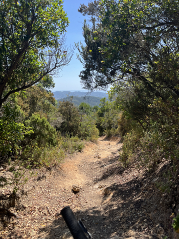
Once you reach Monte Tambone (and the antennas), a short but fun trail begins—now entirely rideable. In fact, near some rock jumps (impossible to bike over), you can take a path that’s fully rideable. In the final stretch, you return to the classic trail with a few technical sections that are easily manageable (and a couple of short rideable climbs). At the Monumento Pass, take the dirt road that climbs, then descends, and then climbs again (keep to the right) up to San Martino. Here, follow CAI Trail 45, which passes to the left of Monte Pericoli and descends toward Colle Pecorino. A nice, flowing descent with a few more technical sections in the final part.
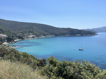
Cross the provincial road and take the dirt road directly across that climbs, then descends until it meets the trail to Biodola. The first section is smooth with a few gullies, followed by a technical section; then keep right toward Biodola, and after a nice traverse, a tough, narrow, and steep descent with steps leads to a beautiful cove. A short climb, then follow the “Sentiero della Salute” (to the left in the final section) to reach Biodola. Climb on asphalt to the provincial road (SP) for Portoferraio, and here take a dirt road to the left that climbs toward Ceppete. Continue on the dirt road to the CAI 51 trail toward Forno. A flowing descent until you reach the trail to Viticcio: here the route becomes more interesting. Still smooth but more technical, with rocky steps, hairpin turns, and steep sections all the way to Viticcio.
Continue on the paved road to the roundabout for Enfola (if you’re not in a hurry, Enfola is worth a visit), then proceed along the provincial road to Portoferraio until you reach a dirt road on the right that climbs (this is the one coming from Ceppete). Climb up to a clearing with a huge (dead) pine tree, and on the right you’ll find a trail that descends to Viticcio. It’s short but technically challenging, with some trial-style sections, ending just above Viticcio. Retrace your steps and head back up the dirt road toward Ceppete; at around 200 meters elevation, take a trail on the left that descends toward Portoferraio. This is also a nice, flowing route that only becomes more technical in the final stretch, with steps and sections over loose rocks and boulders. In Portoferraio, follow the road to Colle Reciso; at the pass, take the forest road to the right that follows the GTE and return to S. Martino. Keep to the right, but at the clearing, take the Guendalone trail to the left. A beautiful technical route, with trial-style sections and very technical riding on rock, including technical passages (an S4 with sections reaching S5). You’ll arrive at Colle di Procchio and, following part of the trail taken on the way out, return to Marina di Campo.