Italiano
 Deutsch
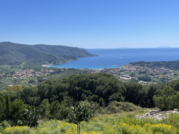
San Piero Bike Park e Colle d'Orano DH

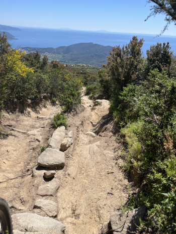
Start from Cavoli, and after a short stretch of paved road, take a forest road that climbs steeply; at a crossroads, take the trail toward Spiero. The trail has a moderate gradient, with a few rocky steps, but is 95% rideable and leads to the lower forest road heading toward San Piero. Follow the paved road toward S. Ilario and take the turn toward Monte Perone. Climb until just past the Torre di S. Giovanni, where the forest road begins, featuring various short trails. Climb the forest road to the upper forest road and take the first trail: Tozzi Carletto. It combines flow sections (in the upper part) with technical passages and rock steps (in the lower part), featuring hairpin turns and small jumps. Turn right onto the forest road to return to the upper forest road, and this time take the Zucca2 trail. A more flow-oriented route but with jumps for all tastes (including some pretty high ones) and small hairpin turns, rock sections, and steps. Here too, turn right onto the forest road and return to the upper forest road. This time, turn left to climb to Masso alla Quata (a climb with hairpin turns, tough and technical sections, but doable).
The descent from Masso alla Quata (Cielo Alto) is challenging, and after the winter season, it’s definitely even tougher: rock steps, technical rock sections, steep drops, switchbacks with steps, and more canyons. You reach the forest road and continue following the Masso alla Quata trail. The second section is mostly on dirt, but it also has several challenging sections, some of which have been eroded by water, posing a risk of getting stuck or tipping over. In the final section, turn left toward Sassi Ritti (the original route would go right toward Molino Moncione and then Cavoli); the Sassi Ritti route is smoother, but here too there are steps, rocky sections, and a nice stone-paved path, leading to the sports fields of S. Piero.
Asphalt all the way to S. Ilario, then a forest road toward Colle Reciso; here, turn left onto a trail that descends (a few technical sections) and then a nice technical climb over rock. Follow the forest road to arrive just below Poggio. A short stretch of asphalt, then take the steep forest road that climbs to San Cerbone (loose rocks) and from there, a trail that leads to the beautiful forest road toward Marciana.
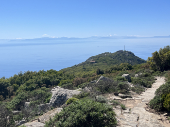
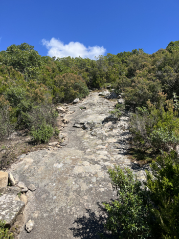
Just before descending to Marciana, turn left to reach the Via Crucis and the steep climb up to Madonna del Monte. The beautiful traverse to Serraventosa, the technical descent with steps at Bollero, and the climb to reach Toppolo. Descend via steps toward the traffic light and then turn right onto trail 176, the Colle d'Orano trail (but it’s a pretty tough DH run!). A very technical, trial-style route over stones and rock, with a few flow sections but mostly steps, canyons, tight switchbacks, and more steps and trial-style sections. In some sections, you’ll need to walk your bike. You’ll reach the provincial road just before Colle d’Orano.
Maximum difficulty S5 #elba