
 Italiano
 Deutsch
2023/04/26 09:09:46
Monte Perone - Elba
Author
Place
Italy - Toscana, LI
Km
14,93 km
Elapsed time
04:08:54
Vertical meters
+1 000 mt (115 - 761)
Route difficulty
Landscapes
Last update
2024/01/04 19:11:42
Comments
Hotels
Description
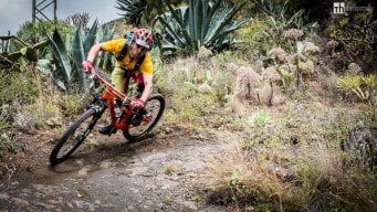
The track misses the first part of the climb. From Palombaia you go up to San Piero, past the village after about 1.5km you turn left and continue climbing towards Monte Perone and reconnect with the track. From here start numerous descents in typical enduro style, from prepared ones with super flow terrain to more natural ones with technical passages on granite and sea views!


Local weather
Fri 00:00

16 °C
Fri 12:00
21 °C
Sat 00:00

16 °C
Sat 12:00
21 °C
Sun 00:00

16 °C
Sun 12:00
22 °C
Graph
Nearest Routes
2024/04/14
- Italy - Toscana, LI 6,95 km
Km
+660 mt
Vertical meters
Route difficulty
Landscapes
35,89 km
Km
+1 500 mt
Vertical meters
Route difficulty
Landscapes
38,95 km
Km
+2 027 mt
Vertical meters
Route difficulty
Landscapes
43,76 km
Km
+1 914 mt
Vertical meters
Route difficulty
Landscapes
67,86 km
Km
+1 500 mt
Vertical meters
Route difficulty
Landscapes
2022/10/02
- Italy - Toscana, LI 34,03 km
Km
+1 800 mt
Vertical meters
Route difficulty
Landscapes
19,75 km
Km
+762 mt
Vertical meters
Route difficulty
Landscapes
47,55 km
Km
+2 000 mt
Vertical meters
Route difficulty
Landscapes
2022/10/02
- Italy - Toscana, LI 50,08 km
Km
+1 900 mt
Vertical meters
Route difficulty
Landscapes
59,88 km
Km
+1 989 mt
Vertical meters
Route difficulty
Landscapes