
 Italiano
 Deutsch
Monte Generoso - Cugnolett - valle di Muggio

All-mountain itinerary along some little-known trails on Monte Generoso. Start from Castel S. Pietro (hamlet of Obino): pay parking (1 CHF/h, 5 CHF/day) along the ascent of via Obino. Immediately take the mule track that leads to the alpe di Caviano hut: the climb is easy technically (paved surface), but strenuous (constant gradient of about 15 percent).
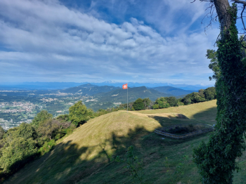
Panorama from the alpe di Caviano, ranging from the Ligurian Apennines to the Aletschhorn
Shortly after the hut the slope becomes gentler, and you cross the bumps area along a road that is first dirt, then paved. In the vicinity of the Bellavista locality you go back uphill on a stony path, although for a fairly short stretch. After crossing the rack railway tracks, a long, very scenic traverse begins that leads up to the summit station (with its restaurant). From an altitude of 1450 meters the trail becomes very steep (slopes close to 20%) and the presence of retaining steps does not make pedaling any easier. It is not for everyone to ride all the way to the end (I push in this section)! I point out that the traverse is identified as a footpath (although I didn't see the sign marking it today), however the presence of cyclists riding uphill on it is tolerated. In any case always give precedence to pedestrians and absolutely avoid riding it downhill!
After arriving at the summit station (about 1600 meters), if the weather is nice, I recommend leaving the bike and walking another 100 m of elevation gain until you reach the actual summit of Monte Generoso (1701 meters): in fact, from here you can enjoy a magnificent 360° panorama of the surrounding mountains and lakes. Detour not shown on the trail.
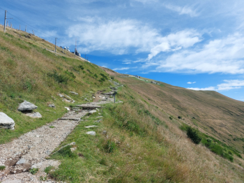
Final section of the ascent to the summit of Monte Generoso
The descent now begins: start along a traverse between pastures, after a few hundred meters turn right and point the front wheel in the direction of the maximum slope. Be careful: this junction is barely visible, you walk a few dozen meters in the grass, then the trail reappears (help yourself with the GPS). This trail is steep, but not particularly technically difficult (diff. S2). It continues steeply until it crosses a trail on the coast, just before the Génor Alp.
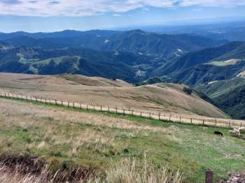
Pastures to be traversed downhill to the Muggio valley.
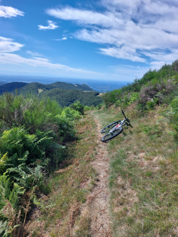
Cugnolett traverse.
Turn right here and continue along this eat-and-drink traverse (Cugnolett), which is narrow and overlooks steep meadows with a few passages between rocks (diff. S2). Once the long traverse is over, you find yourself back on the bumps road already taken uphill, which you now take downhill. At la Grassa, near a fountain with a wooden sculpture, turn left and take a trail that leads into the Muggio valley (diff. S2). The first part has a few non-trivial hairpin bends, then, after reaching the locality of Sassi, you keep right at the next junction, following a stretch on the coast until you reach the alpe Roncaia. Here you skirt the fence of the first farmstead (the renovated one) on the left, until you find a small gate with a sign for the village of Monte. You go through the little gate and drop into a wide rock garden that keeps you entertained all the way to Monte. You cross the village and at the exit turn left to enter a fast and fun trail that leads to Campora (diff. S1), from here short return on asphalt to Obino.
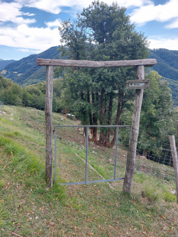
Alpe Roncaia: gate with signpost for the small village of Monte
Itinerary covered on 07/27/2025 with mtb


