
 Italiano
 Deutsch
Monte Pravello e Monte San Giorgio
Italian-Swiss route to 8, very rewarding. I started from the Cantello cemetery parking lot, with some dirt and asphalt I reached Viggiù, where the first climb begins on a road partially closed to traffic that, with average gradient about 9% max 14%, leads first on asphalt then dirt to the top of Mount Pravello. In the final part one can pass by well-preserved sections of the Cadorna line. From the top you can admire the various lakes in the area, several 4000 from Rosa to Aletsch but also Tamaro, Bar and Generoso. Now to the first descent, with a short flat trail you enter Canton Ticino to face the path that between rocks, steep stretches on earth and a few tricky relaunches where you put your foot on the ground, leads to the village of Arzo (a few S3 passages).
Now with a short stretch on asphalt with low traffic you enter the beautiful little valley towards Meride, entered in the village you have to face the hard dirt climb that leads to the top of S.Giorgio (Unesco heritage for fossil site), fund at times very bumpy and with slopes that exceed 20% up to 25%, all pedalable with e-bike or with pro legs. Once at the summit again superb views of Alps, Lake Lugano within diving distance, Val Colla, and again Monte Generoso. Exciting descent along the east ridge, initially pure flow then a few more challenging passages, again S3 difficulty (plus a small unresolved rock drop). At the junction for Riva San Vitale climb back up to Meride, crossed the beautiful village, reach the Crocefisso locality where you take a dirt road that leads to the beautiful fossil path, descent with some very dry raises to Besano. From here return mixed bitumen and dirt road to the car.
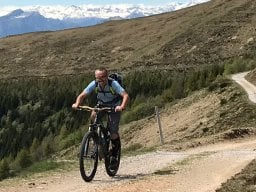
The route was done with e-mtb, on 11/11/2023
You can start from Besano, with parking exactly at the end of the descent, going up the Bernasca climb, unpaved with steep sections ( >10%) until it joins the Monte Orsa/Pravello road.


