Italiano
 Deutsch
Gemelli discesa 212 su Branzi (Il miglior giro della Bergamasca)

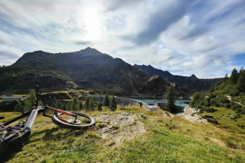
Get ready for a spectacular ride that has practically everything: panoramic views, high-altitude traverses, lakes, exposed sections, and a very long, technical, and physically demanding final descent. The proposed route has about 1,600 m of elevation gain and requires a good level of fitness. This isn’t so much due to long portage sections—which are relatively limited—as it is to the combination of climbs, sections where you have to push your bike, and, above all, the final descent along the CAI 212 trail toward Branzi, which must be tackled while you still have energy in your arms and legs.This route is also suitable for E-MTBs, though you should factor in about 200 m of total elevation gain involving pushing or carrying your bike.
The final stretch on the 212 deserves a clarification right away: it’s a fantastic descent for those who love technical riding, but it’s long, continuous, and physically demanding. If tackled when tired or without a good command of S3/S4 terrain, it can turn the final 1,000 meters of elevation loss into an ordeal.
Isola di Fondra – Branzi – Carona
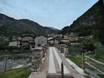
The route starts from Isola di Fondra and begins with a ride toward Branzi.
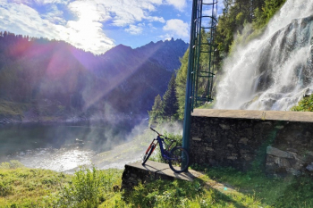
This initial stretch allows you to warm up your legs without much difficulty, passing near a beautiful waterfall before continuing toward Carona.
The real climb begins in Carona.
You’ll take the classic concrete road that climbs the valley with steep gradients.
It’s quite rideable on an e-MTB, although some sections still require strong legs and proper management of the pedal assist.
On a standard MTB, the climb naturally becomes much more challenging.
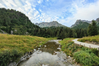
You continue to gain elevation as you enter the beautiful valley above Carona.
Toward Calvi and the detour to Sardegnana
Continue toward the Calvi Mountain Hut, which could serve as an optional stop.
On this route, however, it’s not necessary to reach it: considering the elevation gain and, above all, what remains to be tackled, I preferred to avoid adding another climb.
From here, put on your helmet and protective gear because the nature of the ride changes completely.
After a short descent, a beautiful high-altitude section begins, leading toward the Sardegnana Pass.
Traverse and Ascent to the Sardegnana Pass
The first part is a beautiful traverse that’s almost entirely rideable.
It’s not just a simple ride: there are constant small technical sections that keep the ride interesting and force you to work with your bike.
After that, you’ll need to get off your bike.
To reach the Sardegnana Pass, there’s about 100 m of elevation gain, which involves pushing and, in part, carrying the bike.
It’s not a particularly difficult portage, but with an e-MTB, you really feel the weight of the bike, so you should factor that in before setting out.
Once you reach the pass, you’re finally back on a descent.
Sardegnana Pass – Lake Sardegnana
A beautiful trail starts at the Sardegnana Pass, descending about 150 meters in elevation to the lake.
This is the first real taste of the second half of the ride and finally lets you get back on the bike after the walking section.
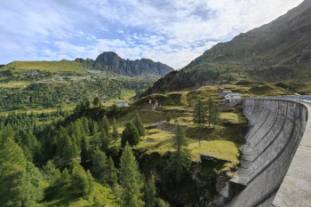
You’ll reach Lake Sardegnana and cross the dam.
From here begins one of the most unique sections of the entire route.
Trail 213: CAUTION: EXPOSURE
Once past the dam, take Trail 213.
Here, I recommend lowering your saddle all the way and paying extra attention.
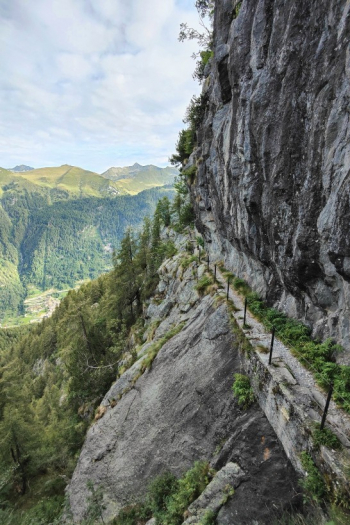
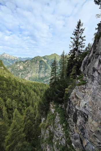
Much of the trail runs directly along the mountain ridge and features a stretch with spectacular views but is also extremely exposed.
On the downstream side, there are sections protected by a metal cable, but this should not be considered a guarantee to hold onto or rely on: there may be loose spots, and it should be viewed solely as an aid.
The trail is rideable for those who feel confident and in control on this type of terrain, but a mistake here can have serious consequences.
It is therefore not the place to test your technical limits.
Anyone who doesn’t feel completely comfortable should simply dismount and walk their bike.
The most exposed section lasts approximately fifteen minutes; afterward, the trail becomes much more gentle, and you can resume pedaling normally.
Lago Marcio - Laghi Gemelli Mountain Hut
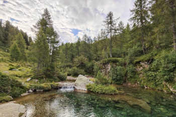
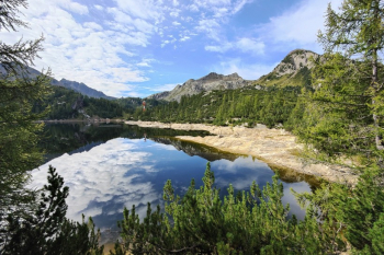
Once you’ve completed the exposed traverse, there are a few more meters of pushing before reaching the Lago Marcio area, characterized by a very distinctive rocky landscape.
You then continue up a short, technical climb toward the Laghi Gemelli Mountain Hut.
It’s a good idea to stop here for a bite to eat and a drink.
The physically most challenging part of the ride is yet to come.
Laghi Gemelli - Lake Colombo - Pian delle Casere
From the Laghi Gemelli Mountain Hut, continue cycling toward the Lago Colombo dam.
From this point on, the day’s climb is practically over.
A long, gentle descent along the hillside toward Pian delle Casere begins.
This section is significantly easier than what’s to come: mostly S2 with a few S3 sections.
The trail lets you find your rhythm and enjoy the surroundings without constantly having to make challenging maneuvers.
But once you reach Pian delle Casere, it’s important to know that the nature of the descent changes radically.
CAI 212 – approximately 1,000 m of technical descent
From here, the highlight of the route begins: the long descent on CAI 212 toward Branzi.
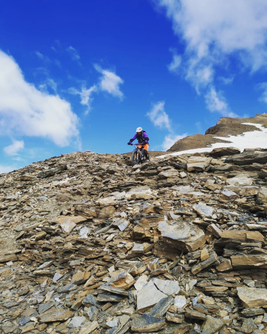
We’re talking about approximately 1,000 meters of elevation loss on a technical, rocky, and very physically demanding trail.
The difficulty is mainly in theS3+/S4 range.
However, this classification should not be interpreted as a few scattered S4 sections within an otherwise easy descent.
The challenge of the 212 trail lies primarily in its continuity.
Rocks, steps, technical sections, and physically demanding stretches go on for a long time, leaving little room to catch your breath.
It’s a descent that demands strong legs, arms, and concentration right to the very end.
If you love this kind of trail, it’s a real treat.
If, on the other hand, you’re already pushed to your limit on the S3, or arrive at Pian delle Casere with no energy left, it risks becoming a succession of sections you’ll have to walk.
So here’s my advice: don’t judge the 212 solely based on the difficulty of any single section. Above all, assess whether you’re capable of riding technical S3 terrain with numerous S4 sections over nearly 1,000 meters of elevation gain.
The surface is generally rocky and stable, and when conditions are good, it offers plenty of grip.
The descent continues practically all the way down to the valley floor.
Alternative: Sirena Descent
Those who reach the final section tired or prefer to avoid the long technical sequence of the 212 can consider the Sirena descent.
This is an alternative worth considering when planning your ride, especially if you’re unsure of your skill level on long, physically demanding S3/S4 descents.
Difficulty: What to Actually Expect
This ride doesn’t present any extreme difficulties throughout the day, but it does include some sections that vary greatly from one another, and it’s important to be aware of them.
Carona Climb: long with significant gradients, but generally rideable.
Sardegnana Pass: approximately 100 m of elevation gain requiring pushing or carrying the bike.
Total portage: approximately 200 m of elevation gain, including the other short walking sections along the route.
Trail 213: technically manageable, but the challenge lies inthe exposure. If you’re unsure, you should carry your bike through this section.
Lago Colombo – Pian delle Casere: mostly S2 with some S3 sections.
CAI 212: S3+/S4, long and very physically demanding. This is the route’s true technical challenge.
Riders with solid all-mountain experience can therefore tackle the entire route without any major issues, but must arrive at Trail 212 with enough energy remaining.
Technical Details
Route style: AM / light mountain biking
Elevation gain: approximately 1,600 m D+
MTB duration: approximately 6 hours
MTB: Yes
E-MTB: Yes
Carrying/pushing: approx. 200 m total elevation gain; some sections require carrying the bike on your shoulder
E-MTB rideability: High
Climb difficulty: Challenging
Sardegnana Pass: approximately 100 m elevation gain requiring pushing or carrying the bike
Trail 213: A short, highly exposed, and roped-off section; carrying the bike is recommended for those who aren’t completely confident
Lago Colombo – Pian delle Casere: S2 with some S3 sections
CAI 212: S3+/S4, long, continuous, and very physically demanding
Maximum difficulty: S4
Exposure: Yes, concentrated mainly on Trail 213 after the Sardegnana Dam
Drainage: Very good under the conditions in which the route was traversed; also tackled the day after heavy rains with good traction
Water sources: Start, Pagliari area, Laghi Gemelli Refuge, and valley floor
Physical demand: High
Technical difficulty: High, especially on the 212
Alternative to Route 212: Sirena descent
Highlight: A comprehensive and spectacular route, featuring high-altitude traverses, lakes, and one of the longest technical descents in the area