
 Italiano
 Deutsch
Val Vedra, Menna, Roncobello

Here's your super loop ride that will take you on two exaggerated descents around Menna! Now you have his options: stay with the unknown of how good those descents will be or set your heart in peace by setting off putting in a lot of meters of pushing, but no need to shoulder. I had long wanted to descend from Menna and redo the Val Vedra I had missed going down into the valley, map in hand I put down the trail.
Start from Roncobello, climb on asphalt in the middle of the woods on comfortable inclines to the Mezzeno huts (water point). Now deflated tires because a nice stretch begins that in about 200m pedalable at 50% (especially with emtb) will take us above Lake Branchino.
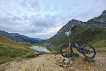
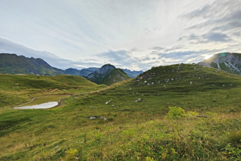
We pedal about a hundred meters to reach the Branchino pass, that descent that calls to us like a siren on the left is the beautiful Fiori trail but today we have to go to Val Vedra. So you continue on the trail and staying high you ride along the valley until the real descent begins, a nice mix of flow, stones, technical passages that closes with a thrilling flow finish that will leave you with a big smile on your face.
NB don't go down the trail at the bottom of the valley, or else you'll have to carry your bike in your hands for a couple of hours.
With the charge of the Val vedra descent we prepare for the climb, 400 meters (up to 1200 elevation) comfortably rideable, final rush of 200 meters of elevation gain on killer steeps doable by aliens or servo-assisted humans. Begin push mode (about 650 meters) on prairie so easily zippable. As an alternative to this climb you can pedal from the easternmost ascent to elevation 1500 and up the gully, but I think you need to put your bike on your back.

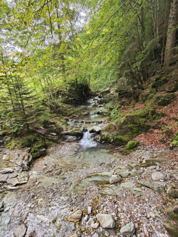
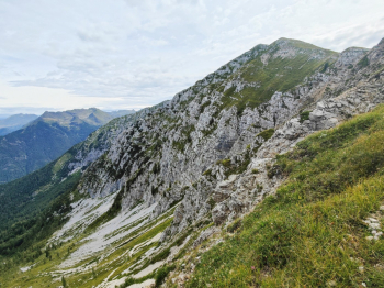
Arrived at the Menna pass with 2100 meters of elevation gain on the legs we observe from afar the summit or if we want to bad we aim to climb it (another 300 meters). From the pass at 2000 meters begins the descent that will close after 1000 meters of negative elevation gain of pure enjoyment. And after a few meters it will make you forget all the effort made. Short initial snake line in gully. Steep on gravel bottom (doable by staying in the grass on the side). All mountain trail with nice technical passages and spectacular forest finish!

Trail style: AM
Personal rating: views 9/10; descents 9/10
Cycletrail: High
MTB: Yes
EMTB: Yes if you don't mind using walkmode
Duration about 8h
Portage: Yes about 200m push up to Branchino and 600m on prairie to Menna Pass
Difficulty climb pedalable: up to mezzeno huts you pedal well, climb from after Zorzone very challenging (I would say only Emtb)
Difficulty descent: Val Vedra S2 medium with some S3 passes; Menna First part S4, then a nice S2 with some final S3 passes
Exposed: No
Drainage: ND
Water points: Roncobello, Baite di Mezzeno, Zorzone


