
 Italiano
 Deutsch
Anello Orobico del Madonnino discesa Cernello (2 giorni)

An epic ride—the kind that stays with you forever. 3,200 meters of elevation gain over 50 km. On my first attempt, I completed the entire loop in 12 hours, but I strongly recommend taking it slower, enjoying the scenery, and stopping to spend the night at the Gemelli mountain hut to break up the journey. In this version, you descend from Cernello: a very technical descent that is uneven in places; for a more enjoyable and smooth ride, I suggest instead descending into the Cardeto Valley by following the other available trail.
Day 1
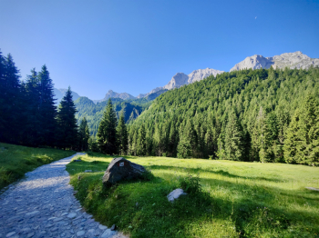
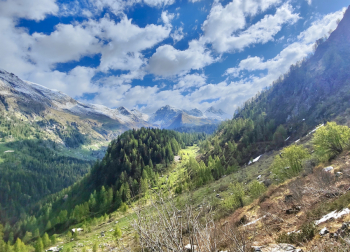
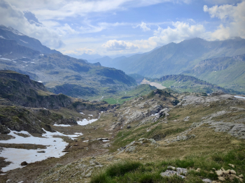
Start from Valgoglio, in the Colarete area, setting off from the convenient parking lot next to the church. Continue on paved road to Bani (where you can refill water), from which we’ll descend via an easy trail. We continue along the comfortable road (another water stop) and, admiring the magnificent east face of Vaccaro and Arera, pass alongside the beautiful Valcanale lake.
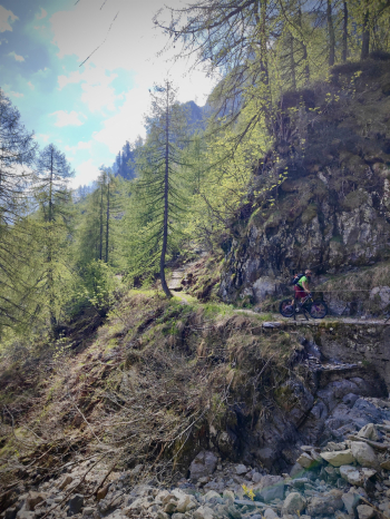
Once off the asphalt, we continue on a concrete path that’s fully rideable, but experience tells me not to push it and to save my legs on the steepest sections. Upon reaching the Alpecorte refuge (open year-round), we set off again with good momentum toward the Branchino Pass. The climb to the pass is fully rideable on an e-MTB, while on a standard MTB you can manage a good 70%. From the Branchino refuge, we stop for a moment to admire the beautiful valley and continue past Lake Branchino, then stop at the pass (1,820 meters) to put on our protective gear. The Branchino–Baite di Mezzeno descent is a classic alpine trail rated S2+/S3, featuring fast sections and several very interesting passages.
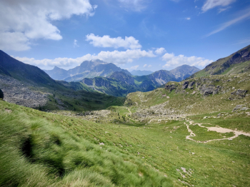
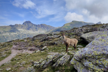
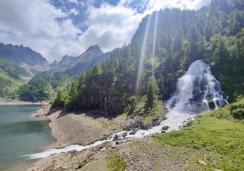
At Baite di Mezzeno (1,600 meters, water source), we hike uphill for about 500 meters with our bikes on our shoulders to the Mezzeno Pass (2,142 meters), from which we can admire the fantastic Roncobello valley, dominated by Mount Menna. The descent from Punta di Mezzeno to Rifugio Gemelli is a very technical S4: once you reach the large boulder, I suggest keeping to the right to avoid getting wedged into the gullies of the left-hand variant. During the descent, the spectacular view of Lake Gemelli opens up before us. At the refuge (1,950 meters, water), we will have covered approximately 1,900 meters of elevation gain (1,200 meters by bike, 500 meters carrying the bike, and 200 meters pushing). For those who have never visited the area, it is possible to complete the 5-lake tour: by climbing about 100 meters of rideable terrain to Lake Colombo, you can then descend toward Lake Becco, Lake Marcio, and Lake Pian delle Casere, before returning to the Gemelli Refuge over about 150 meters of rideable sections.
Day 2
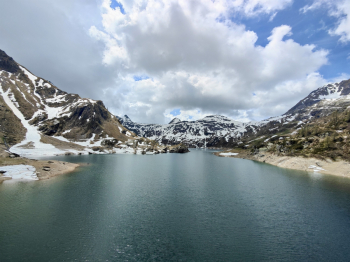
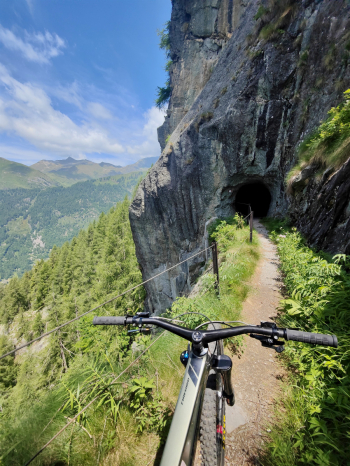
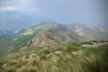
From the Gemelli refuge, we descend directly toward Pian delle Casere Lake and continue along the flat, very scenic trail—though strewn with small rocks—running alongside Marcio Lake. We descend via a rocky S3 trail and then turn onto CAI Trail 213: this is a beautiful S1/S2 trail with breathtaking views, protected but definitely exposed, so exercise extreme caution!
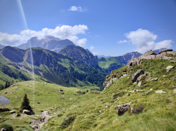
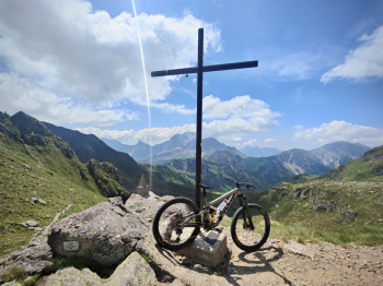
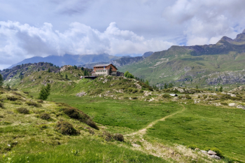
Once we reach Lake Sardegnana (1,750 meters), we carry our bikes to the Sardegnana Pass (1,880 meters). We descend the first 30 meters of the trail on foot, as it is exposed and technical, then continue along a beautiful traverse featuring many sections requiring a push. We connect to the paved road and, passing alongside Lake Fegabolgia, continue pedaling briskly to the Calvi Refuge (2,000 meters). From the refuge, we continue toward the Portula Pass (2,273 meters), carrying our bikes for about 300 meters. The views from the pass are fantastic! Now there are just the final 220 meters to carry our bikes to reach the summit of Madonnino (2,502 meters), with a spectacular 360° panorama.
Descent
From Madonnino down to 1,550 meters, we tackle a moderate S4 descent with sections that aren’t always rideable (alternatively, you can follow the dedicated trail). The first 200 meters are steep S3/S4 sections that are almost entirely rideable, followed by alternating rideable sections and S4 sections. Once on the cart track at 1,550 meters, continue (water point) on a freeride through the woods, descending parallel to the road. Keep right at the fork at 1,480 meters to take a beautiful S2 trail full of roots. We finish the ride with 400 meters of final mule tracks which, unfortunately, are not very interesting.
Tips and Alternatives
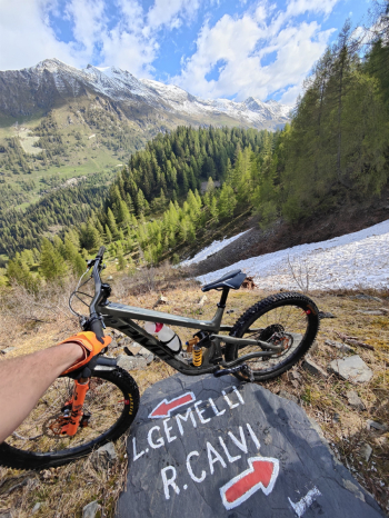
From the Gemelli, you can descend via Route 212 (this trail) and find lodging in Branzi; the next day, you’ll climb to Calvi by cutting across the entire scenic Route 213 traverse. You can climb up to just below Pizzo del Diavolo di Tenda or head up into Val Sambuzza (this route), or add another day and climb via one of the other routes in the area (such as Passo di Val Cervia, this route)
Route style: All-mountain
Personal rating: Views 10/10; Descents 8/10
MTB: Yes
EMTB: Not recommended
Duration: approx. 16–20 hours (by MTB)
Carry: 1200m
Ascent difficulty: very challenging in places
Descent difficulty: P.Branchino 350m S2 / P.Mezzeno 250m S4 / Colombo 200m S2 / P.Sardegnana 150m S2+ / Madonnino 1000m S4 / Trail Radici 300m S2 / Final mule trails 400m S1
Exposure: Some protected sections on traverse 213
Drainage: YES
Water sources: See description


