
 Italiano
 Deutsch
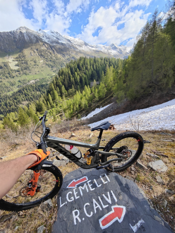
Anello Orobico del Madonnino discesa Cardeto (2 giorni)

An epic hike—the kind that stays with you forever, etched in your heart and your legs. We’re talking about 3,200 meters of elevation gain and 50 km of pure adventure, culminating in the final descent through the beautiful Cardeto Valley. On my first attempt, I completed the entire route in 12 hours, but my advice as a friend is to take it slower: enjoy the monumental landscapes and stop to spend the night at the Gemelli mountain hut. Compared to the Cernello variant, the final descent here is more beautiful, continuous, and rewarding.
DAY 1: Toward the Heart of the Orobie
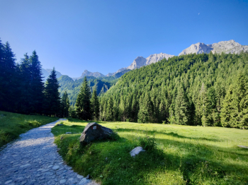
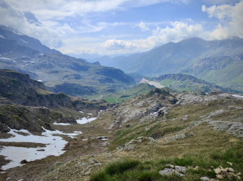
We start from Gromo, warming up on the asphalt toward Valcanale. As we climb the easy road (water stop), our gaze is captivated by the magnificent east face of Vaccaro and the mass of Arera, passing alongside the picturesque little lake of Valcanale. Once you leave the asphalt behind, you hit a concrete path that’s fully rideable, but here’s a tip: don’t push it. Save your energy for later and don’t burn out on the steepest sections.
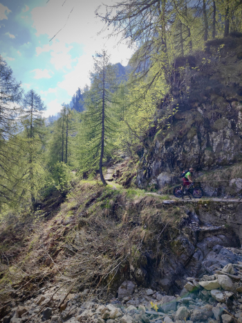
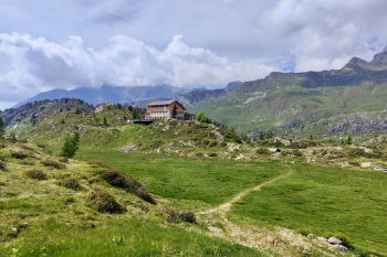
Once you reach the Alpecorte refuge (open year-round, water available), you set off again with good momentum toward the Branchino Pass. On an e-MTB, the climb is pure enjoyment from the saddle, while on a regular bike, you’ll be pedaling hard for a good 70% of the way. From Branchino, stop to take in the view of the valley, pass the lake, and stop at the pass (1,820 meters) to gear up: put on your protective gear because the classic S2+/S3 alpine trail begins—fast and featuring technical sections that really bring out the best in your riding.
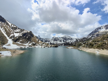
At the Mezzeno huts (1,600 meters, water), the easy ride ends: 500 meters of carrying your bike await to conquer the Mezzeno Pass (2,142 meters). From the summit, the view of the Roncobello valley and Mount Menna is breathtaking. The descent toward the Gemelli Refuge is a very technical S4: when you reach the large boulder, keep to the right or you’ll get wedged into the gullies of the left-hand variant. During the technical section, Lake Gemelli appears before you like a mirage. At the refuge (1,950 meters, water), you’ll have covered 1,900 meters of elevation gain (1,200 meters by bike, 500 meters on your shoulders, and 200 meters pushing). If you still have energy left, the tour of the 5 lakes (Colombo, Becco, Marcio, Casere) is an exploratory “must.”
DAY 2: The Infinite Traverse and the Summit
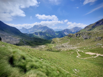
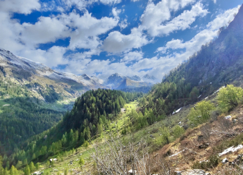
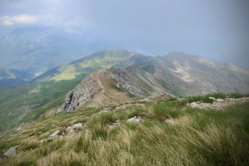
From Gemelli, descend toward Lake Pian delle Casere and follow the flat trail alongside Lake Marcio: breathtakingly scenic but littered with small rocks that require caution. After a rocky S3 section, turn onto the legendary CAI 213: a panoramic S1/S2 trail, protected but decidedly exposed. Here, utmost caution is required: enjoy the view but stay alert!
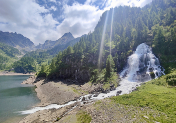
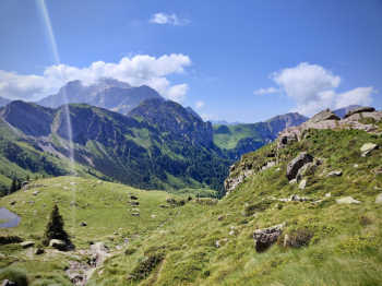
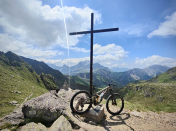
Once you reach Lake Sardegnana (1,750 m a.s.l.), switch to carrying mode until the pass (1,880 m a.s.l.). The first 30 meters of descent are done on foot (technical and exposed), then a spectacular traverse begins, full of adrenaline-pumping sections. You rejoin the paved road and, passing by Lake Fegabolgia, pedal hard all the way to the Calvi refuge (2,000 meters). From the refuge, head toward the Portula Pass (2,273 meters) with another 300 meters of carrying/pushing. Fantastic scenery, but the final push remains: a 220-meter vertical portage to reach the summit of Madonnino (2,502 meters). A simply top-notch 360° panorama.
The Final Descent: The Ecstasy of Cardeto
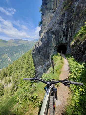
From the summit, the first 200 meters are steep S3/S4, almost entirely to be ridden with your heart in your throat. This is followed by a short, unrideable traverse toward the Portula Pass. From here, the true magic of the Cardeto Valley begins: the first section is an S3 with several S4 sections, but unlike Cernello, here the descent is continuous and smooth. The difficulty decreases as you descend, turning into a lightning-fast S1 on the final trails that will bring you back down to the valley with a smile you won’t be able to wipe off your face.
Tips and alternatives: from Gemelli, you can descend via Route 212 (this route) and find lodging in Branzi; the next day, you’ll climb to Calvi by cutting across the very scenic Route 213 traverse. You can ascend to just below Pizzo del Diavolo di Tenda, or climb into Val Sambuzza (this route), or add another day and ascend via one of the other routes in the area (e.g., Passo di Val Cervia (this route)).
Video of the complete tour with descent from Cernello
Video of the descent from Madonnino in the Cardeto Valley
Route style: All-mountain
Personal rating: Views 10/10; Descents 9/10
MTB: Yes
EMTB: Not recommended
Duration: approx. 16–20 hours (by MTB)
Carrying distance: 1200m
Ascent difficulty: very challenging in places
Descent difficulty: P.Branchino 350m S2 / P.Mezzeno 250m S4 / Colombo 200m S2 / P.Sardegnana 150m S2+ / Madonnino 200m S4 / P.Portula S3 / Final trails S1
Exposure: Some protected sections on traverse 213
Draining: YES
Water sources: See description


