

 Italiano
 Deutsch
Passo dello Zulino

A beautiful all-mountain ride that combines the climb to the Alpe Corte Mountain Hut, a long traverse through the woods, the portage to the Passo dello Zulino, and the descent through the Val Sanguigno to the Gianpace Mountain Hut. It’s a fairly well-rounded route: a challenging climb that’s almost entirely rideable, a single real portage section, and two beautiful descents, with a few technical sections that shouldn’t be underestimated. This ride is particularly well-suited for E-MTBs, but you’ll need to be able to push hard and, in some spots, carry your bike for about 20 minutes before reaching Passo dello Zulino.
Valcanale – Alpe Corte Mountain Hut
After an initial climb and an easy S1 descent, you reach Valcanale, where the second and main climb of the day begins.
Up to about 1,100 meters, the route proceeds comfortably on paved roads.
From here, the climb changes character significantly and continues on a dirt road with steep gradients, averaging around 20% in the most challenging sections.
On an e-MTB, it’s generally rideable, though it still requires good technique on the steepest sections.
On a standard MTB, however, it becomes a very challenging climb: the fittest riders may be able to pedal most of the way, but for many, it will be necessary to push the bike on some sections.
The route continues like this all the way to the Alpe Corte Mountain Hut.
Alpe Corte – traverse toward Zulino
From Alpe Corte, one of the most beautiful sections of the route begins.
You’ll take a long traverse through the woods—about 3.5 km— that’s a lot of fun to ride and completely different from the steep climb you just tackled.
This section alone is worth a good part of the ride: smooth, technical, and immersed in the woods, with constant changes in pace.
Continue until you reach the area below the Passo dello Zulino.
Ascent to the Zulino Pass
The first part crosses a large meadow, and on an E-MTB you can still gain a bit of elevation while in the saddle.
After that, however, you’ll need to get off the bike.
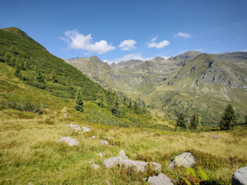
From here to Passo dello Zulino, expect about 20 minutes of pushing and carrying the bike, covering an elevation gain of around 200 meters.
It’s not a mountaineering section or particularly exposed, but with an e-MTB, you’ll really feel the weight of the bike.
In some spots, you can push the bike, while in others it may be more practical to carry it on your shoulder.
It’s the only real portage section of the day, and for most mountain bikers accustomed to the mountains, it remains manageable—but it’s important to know this before setting out.
Riders using a very heavy E-MTB should, above all, make sure they can handle it comfortably while dismounted.
Zulino Pass - Val Sanguigno
Once you reach the Zulino Pass, the most interesting part of the descent finally begins.
The first sections are also the most technically challenging.
There are 2–3 S4 sections—short but challenging—where riders without solid technique can safely dismount and walk through them.
So this isn’t a long S4 descent.
Once you’ve passed these sections, the difficulty level drops, and the descent becomes mostly S3, gradually alternating with several S2 sections.
The trail is very scenic and allows for more continuous riding as you lose elevation.
You then enter Val Sanguigno, crossing the distinctive footbridges over the stream.
Val Sanguigno - Gianpace Mountain Hut
After the footbridges, continue through the valley until you reach the Gianpace Mountain Hut.
The scenery here is particularly beautiful, and the trail becomes progressively easier to navigate compared to the upper section.
From the refuge, however, one of the most enjoyable descents of the day still lies ahead.
Gianpace Mountain Hut - Final Descent
From Gianpace, a beautiful trail winds through the woods—fast, rocky, and a lot of fun.
The trail surface has plenty of rock, but it’s generally compact and offers excellent traction, even when slightly damp.
The difficulty level remains mostly between S2 and S3.
It’s a descent where you can get into a good rhythm and let the bike run free, without facing the challenges of the few sections encountered below the Passo dello Zulino.
Once the trail ends, you rejoin the road and return to the starting point on a gently descending paved road.
CAUTION: Hikers
The descent from the Gianpace Mountain Hut is also very popular with hikers.
The trail is shaded, easily accessible, and also used by families with children, especially on hot days.
For this reason, I do not recommend this route during peak seasons, particularly July and August.
Even in other seasons, a hot Sunday can mean encountering quite a few people on the trail.
If possible, it’s best to choose a Saturday, a weekday, or cooler, less crowded times of year.
It’s not just a matter of safety: such a beautiful descent loses much of its appeal if you have to keep stopping to pass groups of hikers.
In any case, hikers have the right of way, and in areas with limited visibility, you should maintain an appropriate speed.
Difficulty: What to Really Expect
The ride is within the reach of many bikers with decent all-mountain experience, but there are three things to know before setting out.
Ascent: From Valcanale to Alpe Corte, the gradients become steep. On an e-MTB, it’s almost entirely rideable; on a conventional MTB, however, it requires a very good level of fitness.
Portage: Below the Passo dello Zulino, you should allow about 20 minutes of carrying your bike, alternating between pushing and a few spots where you may need to carry it on your shoulder.
Descent: From Passo dello Zulino, there are 2–3 S4 sections, but they’re isolated and can be easily bypassed on foot. The rest of the descent transitions to S3 and then to S2/S3.
It is therefore incorrect to classify the entire route as S4, but neither is it simply S2: anyone tackling the trail should be aware that those few technical sections exist.

Technical Details
Trail Style: AM
MTB: Yes
E-MTB: Yes, recommended
E-MTB duration: about 4 hours
E-MTB Rideability (Ascent): Very high, excluding the final section at Zulino
Ascent difficulty: Challenging from Valcanale; steep climbs toward Alpe Corte
Alpe Corte traverse: about 3.5 km, very fun
Carrying the bike: about 20 minutes / about 200 m elevation gain, some sections requiring a push and a few spots where you may need to carry the bike on your shoulder
Zulino Pass to Val Sanguigno: initially 2–3 short S4 sections, then mostly S3 and S2
Gianpace to the valley floor: S2/S3, fast and rocky
Overall descent difficulty: S2/S3 with 2–3 localized S4 sections
Exposure: Not particularly significant
Traction: Good, especially on the descent from Gianpace; rock provides plenty of grip even when slightly damp
Crowds: High in summer in the Gianpace area; if possible, avoid July and August and the busiest days
Highlight: Traverse from Alpe Corte, the Val Sanguigno setting, and the long final descent


