Italiano
 Deutsch
Rifugio Brunone

Brunone Mountain Hut: Total Mountain Biking and the Verticality of the Orobic Alps
Forget about compromises. This isn’t a mountain bike ride—it’s an expedition. The Brunone Mountain Hut embodies the essence of mountain biking’s hardship: an endless ascent with your bike as a companion on your shoulders and a descent that is a monument to extreme technical skill. A route for those seeking the isolation of high altitudes and unafraid to face the harshness of the Orobie Alps.
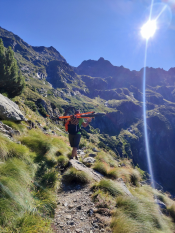
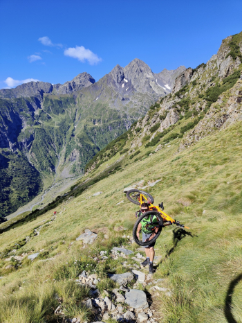
The Ascent: The Endless Ordeal of Carrying Your Bike
The start is set at Fiumenero, where you can still find a few free parking spots before entering the village. The reality of the ride becomes clear after just 200–300 meters: the rideable terrain ends abruptly, giving way to a brutal portage with 1,400 meters of elevation gain. You climb the trail that will later be the scene of the descent: a constant, steep ascent where the bike becomes a burden to be tamed step by step until you reach the Brunone Refuge. Fortunately, the presence of the refuge and a few small streams along the climb provide the necessary water stops to keep you from running dry.
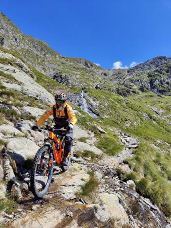
The Descent: A Thousand Meters of Technical “Hardcore”
Forget speed and flow; here, the descent is a test of balance, strength, and nerves of steel.
- The Start: From the refuge, you set off on an S3 section up to the junction for the Passo di Valsecca trail. It’s just the technical appetizer before the main course.
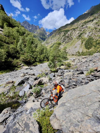
- The Heart of the Descent: From here begins a vertical abyss with a 1,000-meter drop and a constant S4 difficulty. It’s a succession of S5 sections where trial riding is the only language spoken.
- The Limit: You’ll also encounter a short S6 section: here, the exposure and steepness exceed the limits of rideability and common sense, forcing you to dismount to safely navigate the obstacle.
- The Finale: The final 300 meters finally ease to an S3 grade, allowing you to loosen up your muscles a bit before “letting go” completely on the final S1 section that leads back down to the valley.
Trail Style: All-mountain
Personal rating: Views 8/10; Descents 8/10
MTB: Yes
EMTB: No
Duration approx. 5-6 hours (on MTB)
Carry: 1400m
Ascent difficulty: 200m very challenging, then carry the bike the rest of the way
Descent difficulty: 80% S4 | 15% S3 | 5% S1
Exposure: Normal exposure for a steep trail; the most exposed section is the S6 section, which cannot be ridden
Exhausting: YES
Water sources: Mountain hut and a few small streams on the ascent