Eridio, Alpo, Cima Spessa, DH 444
Following the Sforza footprints (see biking trail), north of Lake Idro (Eridio), I climbed this summit, not at all cyclable in the last 200 meters of elevation gain either up or down, but very scenic. All in all, a really nice ride in a wild and intact environment, with a rather long and challenging ascent and a fun descent, far from trivial with alternating technical and flowing passages.
The difference from the friend's ride lies in the second part, where I circumnavigated Spessa, up to the meadows of the same name to undertake the descent of trail 444, toward Storo, reconnecting only at the end to the above-mentioned trail.
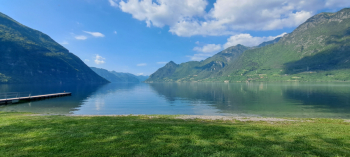
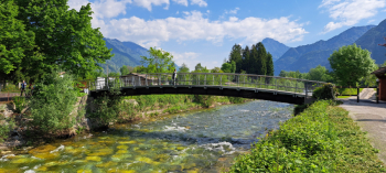
The trail is all on Trentino territory, except for the departure from Pian d'Oneda, Ponte Caffaro (BS), at a small convenient parking area on the bank of the Caffaro stream (drinking fountain). We cross the latter on the small bridge, and by bike we pedal through this beautiful area made of three streams: Caffaro, Palvico that flow into the Chiese River just before flowing into Lake Idro.
After this very pleasant start, at the locality Baitoni, in the municipality of Storo, we begin the ascent on bitumen to the ancient, small village of Bondone. Immediately after the third hairpin bend, we take a detour to the right to reach the castle of S. Giovanni (be careful, although partly cyclable this short, well-maintained path is necessary to do it bike in hand by prohibition). From the castle we continue on a dirt road until we return further uphill to the paved road, which we climb back up to the small village.
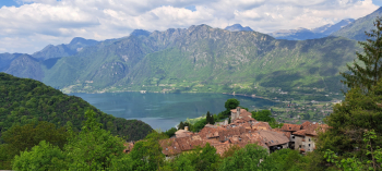
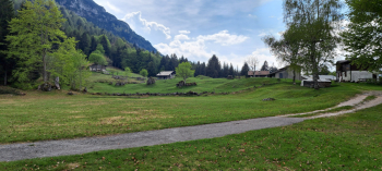
Beyond the village the climb continues with steep slopes (15%) to the green and sunny Malga Alpo di Storo, about 1500 meters.
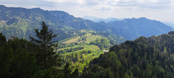
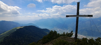
Immediately afterwards the very wild trail to the summit begins on the left, not very visible in the first part (a few faded off-white markers and some webbing hanging from branches (those who do not want to climb can continue the trail from here). It's a push and then a shoulder climb. Gradually the climb gets steeper until you reach a saddle, at meters 1640 (I left my bike here and it is already too much, better to leave it further down). The last 150 meters of elevation gain are done strictly on foot, on very steep terrain in the middle of a mughera where it is often necessary to hold on with one's hands. Reaching the summit, m 1820, we enjoy the fantastic panorama, over the northern part of Lake Idro and the Chiese plain, the Adamello massif, the southern buttresses of the Brenta Dolomites group, and the nearby Tombea and Caplone.
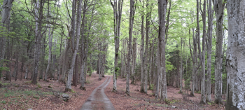
Back at the saddle, in downhill gear we face only the first few meters on the pedals, then it will be an up and down from the bike depending on our ability, however for about half of it it is not cyclable. Back at the hut we turn left on a grassy road to a nearby junction where we follow left, on the level a small asphalt but soon gravel road that enters a stupendous beech forest, circumnavigating the Spessa peak. At a sharp curve to the left, at an altitude of 1410, we veer right, descending briefly on a path along the wooded ridge, to turn sharply left after a hundred meters, pedaling along a flat path. We soon reach the meadows of Spessa, at meters 1383.
At a post with signposts we begin our descent on trail 444. At a subsequent fork we keep to the left, still following the same trail sign for Storo. Further down the trail crosses an old, rutted road several times until we reach the Nar meadows. At an elevation of 850 meters pay attention to a small road on the right that leads to a beautiful little house with a lawn in front of it. BEWARE, we ride along it bike in hand, very politely and asking permission if necessary, since we are on private property. At the end of the little meadow begins a beautiful, fun narrow path that ends on a dirt road. We go up it for about seventy meters of elevation gain, at the point where the bottom becomes cemented, rejoining the bike trail, to the right begins the last path, spectacular, fun, in places exposed with steps and steep technical difficult passages, do CAUTION.
The trail ends at the Scaletta bridge, over the Palvico stream, from here, on a nice bike path we return enjoyably to the starting point.


 Italiano
 Deutsch