Italiano
 Deutsch
Dosso Alto cresta sud

This beautiful mountaineering cycle all takes place in the beautiful Bagolino area and follows decidedly unseen trails, wild even for hikers (in the downhill segment) so when the trail disappears before our eyes patience, it will be our experience combined with our sense of direction that will keep us on track. But as always easy to say less so in practice, I in this case made a mistake and gambled on a very enjoyable part of the descent up to that point.
We start at the Romanterra bridge (parking for 4 cars on the state highway) and go all the way up the Berga valley until we join the road from Baremone to Maniva. We ride 6 km and 700 meters of elevation gain pedaling first comfortably on bitumen then more strenuously on dirt road with a few short steep ramps and in the final part, to reach the pass, 150 meters of elevation gain await us with bikes on our backs on an all in all comfortable path. We are on the wonderful road that shortly takes us to the Dosso Alto pass.
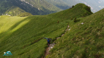
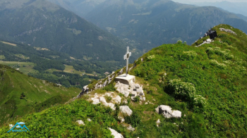
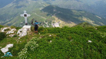
Here the riding ends, we cross with a little discomfort for the first 50 meters of elevation gain in a mugheta and then the alpine prairie accompanies us to the summit on a path that is never challenging with bike accompanied on the side or on the shoulder according to preference.
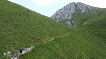
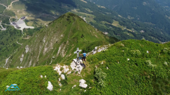
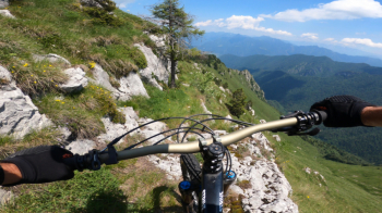
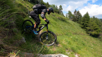
Contemplating and savoring the immense panorama we descend from the south ridge, fun, scenic and you ride it all the way down, then the alpine prairie has the upper hand and on a barely visible path but marked by the Cai polacchini we ride a very long grassy diagonal where the unevenness of the bottom and not the difficulty or exposure force us to keep our attention high. The trail now bends to the left and the path is more obvious and passing over modest rocky crags remains playful until it enters the woods.
Here my mistake, after the "Pisisidolo" sign, our destination, I lose the trail, the track I made indicates a ridge to the left while a pseudo-track and a polacchino on a fir tree on the ground descend to the right into a gully, I decide to follow the polacchino as I do not see the counterpart of my trail, colossal mistake, no trail, dense vegetation, very steep slope and sudden but predictable rock jumps for 300 meters of negative elevation gain and then get onto an alternate trail that takes me to the predefined trail.
Therefore of this trail I do not describe because I did not ride the segment from Km 12 to about Km 14.
Back on the trail the fun resumes until the loop closes where we parked the car.