Italiano
 Deutsch
Fosso Del Ferone Monte San Lorenzo
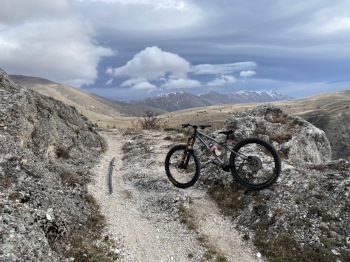
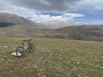
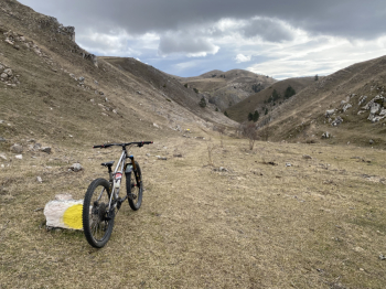
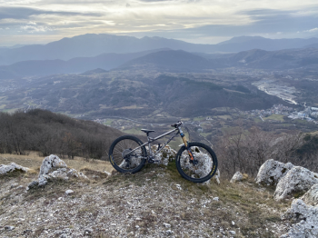
We start from Barete, a small town a few kilometers from L'Aquila. Via asphalt I reach the village of Arischia and from here the climb to Fonte Ovindoli begins via trail 121. Initially a dirt road, about halfway up, at a drinking fountain, 121 becomes a beautiful and scenic all-pedaled single track that climbs close to Fosso Del Ferone, with Gran Sasso in the background. After about a couple of hours of climbing I am at the entrance to Fosso Del Ferone. Recently cleaned up by the Vallone delle Cese guys, it is in perfect condition. It's a fast flowing trail with a few rock passages in a really scenic setting that quickly slides down the valley and brings me back down to Arischia. From here it's back to Pizzoli and precisely to Dragonetti Castle where the second ascent begins on a comfortable white road that climbs quietly without particular difficulty to the Casette Recchiuti. Once past these, turn left and go toward the Rifugio Santa Pupa, which I go to visit after a short anda/rianda. From here after a short section to be done by bike on the shoulder, about 100 meters of elevation gain, I arrive at the summit of San Lorenzo. The path down from the summit is not marked on the maps and the initial part is barely visible. I recommend taking care not to get off the gpx trail. As you descend the trail becomes more and more evident and in the final part it also gives some nice passages on rock. About halfway down you rejoin trail 20, which is much more obvious and well marked because it is a Cai. After a quick serpentine in the woods and some nice passages on rock, you arrive at the starting point. Very nice and affordable tour with two nice fast descents and no particular technical difficulties. Comfortable and pedaled climbs, apart from the final 100 meters to reach the summit of San Lorenzo, which can also be avoided if desired by taking trail 20 directly near the Santa Pupa Shelter.