Italiano
 Deutsch
Tour del Gran Sasso
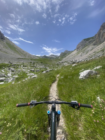
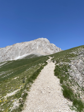
Absolutely spectacular tour on the Gran Sasso, the enormous effort is repaid by breathtaking views and an endless descent that I personally consider among the most beautiful on the Gran Sasso. The tour is a loop with departure from Casale San Nicola in the direction of Cima Alta. The road immediately climbs quite steeply. The first 800 meters of elevation gain are quite hard although a good half you manage to pedal. Once you reach Cima Alta you lose a few meters of elevation on asphalt until you reach Prato di Tivo. From here you go to the entrance of Val Maone, one of the most beautiful and evocative valleys of Gran Sasso. After about a hundred meters of elevation gain, you arrive at the source of the Rio Arno, the last point where you can make water. From here on it will be bike-only, except for a few short pedaled sections.
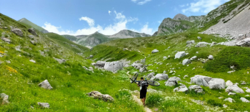
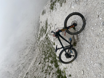
You go up the whole valley to Capanne di Val Maone and then go left to the Garibaldi refuge. A short stop at the refuge with reintegration and then we start again with the climb, which in the last part becomes more challenging until we finally reach Mount Aquila, which at 2494 meters is the highest point of the tour. From here on it will be all downhill. As soon as you start from the summit you have to be careful because there is a piece carrying the bike by hand to climb over some exposed rocks, if you go in two or more people it is advisable to pass the bikes to each other. Once back in the saddle the fun begins.
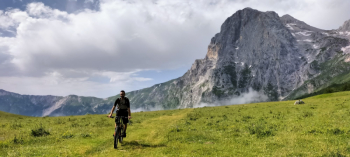
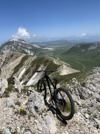
First part of the descent all on ridge with a beautiful panorama as a backdrop. This first section is very smooth and presents no particular difficulty, in some places it gets a little steeper but nothing difficult. You descend until you reach Vado di Corno and from here begins the last and longest part of the descent, the most adrenaline-pumping. An endless succession of switchbacks on a rocky surface. The first part on fixed rock and then as you lose altitude it becomes more loose. Numerous technical passages that require nose press and advanced riding technique if you want to get the upper hand, a real school of mountain biking. We arrive down at the cars after 8 hours 40, 28km and over 2100m of elevation gain of which more than 1600 with bikes on our backs. Tour for extreme lovers that requires proper physical preparation as well as good downhill riding technique.